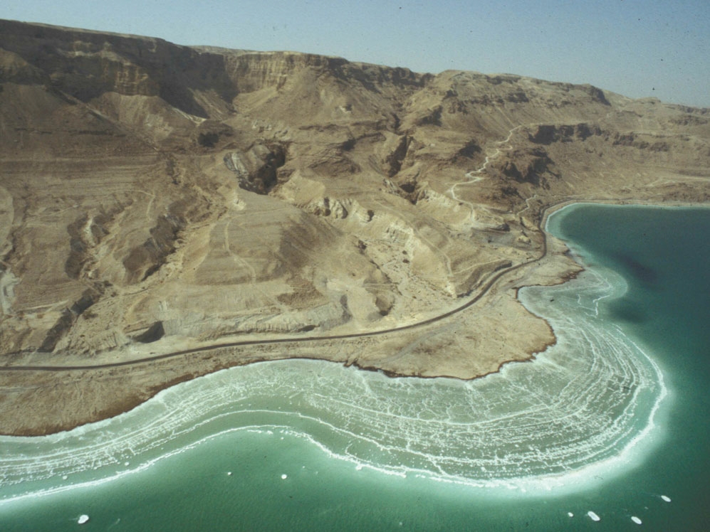
Most people know that the Dead Sea is a very salty place. And they are right, though there’s much more to it. The Dead Sea, for one thing, is a really large, really salty place – 34% salts compared to 3.5% for sea water. It’s 31 miles long, 9 miles wide. More specifically, the Dead Sea is a hypersaline lake in a closed drainage basin that lies between Jordan and Israel. The Dead Sea represents a dead end to all its tributaries, including its largest source of new water, the Jordan River.
If water flows in but doesn’t flow out, then where does it go?
The first people to set their eyes upon the Dead Sea may or may not have asked themselves the same question. Some ancients, such as the Greek Thales of Miletus (648-546 BCE)(1), believed the earth rested on water and that springs and even rivers had their sources from below. The Dead Sea could have been connected to this subterranean sea and thus subject to changing volume. Today, we know that the waters of the Dead Sea simply evaporate.
From the earliest times, it would also have been evident that this lake does not have a constant shoreline like the Mediterranean Sea does. The Dead Sea shoreline fluctuates greatly, with discernible changes occurring on an annual basis. These fluctuations are the result of two primary factors: the input volume from the Jordan River and the rate of evaporation.

Over the last century, evaporation has exceeded the input of new water. As a result the Dead Sea has shrunk considerably in size. In 1930, the surface was 1280 feet (390 meters) below sea level. Its surface has dropped more than 120 feet (37 meters) to date, with most of that water loss occurring in the last 20 years. Like the Colorado River that is sucked dry by agricultural and urban sprawl before it reaches the Pacific Ocean, the Jordan River is almost all used up by a thirsty population, leaving just a small stream to feed the Dead Sea. Starved of its primary water supply, the Dead Sea is shrinking at historically high rates. In the last decade, it has dropped about three feet each year.

This drop in surface level of the Dead Sea has left resorts built in the middle of the twentieth century 100 feet above the current shore, and some are thousands of feet away. Any new construction along the shore must take into account the likelihood of further lowering of the lake. In addition, sinkholes dot the plains that were once under the Dead Sea. Layers of rock salt below this exposed former lake floor are being melted by groundwater, creating dangerous caverns which are prone to sudden collapse.

How Low Can It Go?
Despite being the lowest place on earth the Dead Sea waters themselves reach a depth of almost 1000 feet. At its current rate of evaporation the lake could completely dry out in less than 500 years, though ever increasing salinity would likely slow evaporation as the lake shrinks.
Historical Highs and Lows
The future may witness much lower Dead Sea levels, but what about the past?
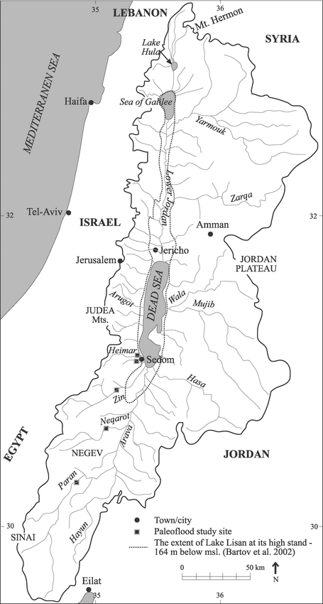
There is abundant evidence, which we will examine in subsequent posts, that the Dead Sea has experienced dramatically different lake stand levels over time. At the one extreme, the sea nearly dried up completely, leaving the shore more than 2000 feet below sea level. Yet the sea has also seen far higher water levels, to the point that the Jordan Valley was once the site of a lake that combined the Dead Sea and Sea of Galilee into one lake, which was more than 700 feet higher than the Dead Sea today.
But how long ago and under what conditions could these very different lakes have occurred?
Fitting the Dead Sea into the Biblical Timeline
The Dead Sea has both a rich geological history and a long history in the annals of recorded human history, especially the Bible. The Dead Sea is referenced in the Scriptures from early in Genesis all the way through the Gospels of the New Testament. This record allows us to establish some strong constraints on the timeline of the origin and evolution of the Dead Sea and Jordan River valley.
If the Dead Sea nearly dried up in the past, how long ago did that event occur? It must have happened before the time of Abraham, but how long before? And when was the Jordan Valley nearly full of water, cutting away ancient shorelines still evident today, which were hundreds of feet above the current shores?
This latter event must have been before the time of Abraham. We will see that the Bible provides firm evidence that the Jordan Valley that Lot and Abraham looked down upon 4000 years ago had a Dead Sea of similar proportions to the one that we see today. Furthermore, the Bible provides no indication that since that time the Dead Sea has grown or shrunk radically in recorded history. Thus any record of other stages in the development of the Dead Sea region must have taken place prior to recorded history.
Over the next month we will explore the geological and biblical evidence of the origins and future of the Dead Sea. We will do this by examining the huge body of geological evidence that has been collected on the Dead Sea area, and we will look at what the Bible has to say about the Dead Sea and its origins. I believe the evidence presented from both of these sources will demonstrate that the Dead Sea is a powerful testimony of an ancient earth and supports the authority and historicity of the Bible at the same time.
Next up: Dead Sea Origins Part III: The Jordan Valley – A Land Literally Ripped Apart
1. http://www.iep.utm.edu/thales/ Thales of Miletus entry in the Internet Encyclopedia of Philosophy


Fascinating!
LikeLike
Thanks, hopefully this is just the teaser for what is to come. I’ll get into the geology in the next post and then work my way around to seeing how the data fit into the Bible and specific interpretations of the Bible. joel
LikeLike
Really looking forward to that!
LikeLike