I recently posted a YouTube video about a geological story I had not heard of until about a month ago, and I suspect many of you have not heard of it either. When most of us imagine an asteroid streaking toward the Earth, we picture the Chicxulub impactor bearing down on the Yucatan Peninsula, the strike usually tied to the demise of the dinosaurs. (I have a separate video on that crater in the works, and I hope it will be worth the wait.) The impact I want to describe here was not heading for Mexico. It was heading for the Korean peninsula, for a spot a little southwest of Seoul, long before there was any Seoul there to notice it.
This is, first of all, a wonderful piece of straightforward science. But as so often happens, a wonderful piece of straightforward science turns out to be a serious problem for the flood geology of young-earth creationism. So let me walk through the science first, and only then come back to the question I keep returning to: what is a young-earth creationist supposed to do with a site like this?
An Impact Crater Hiding in Plain Sight
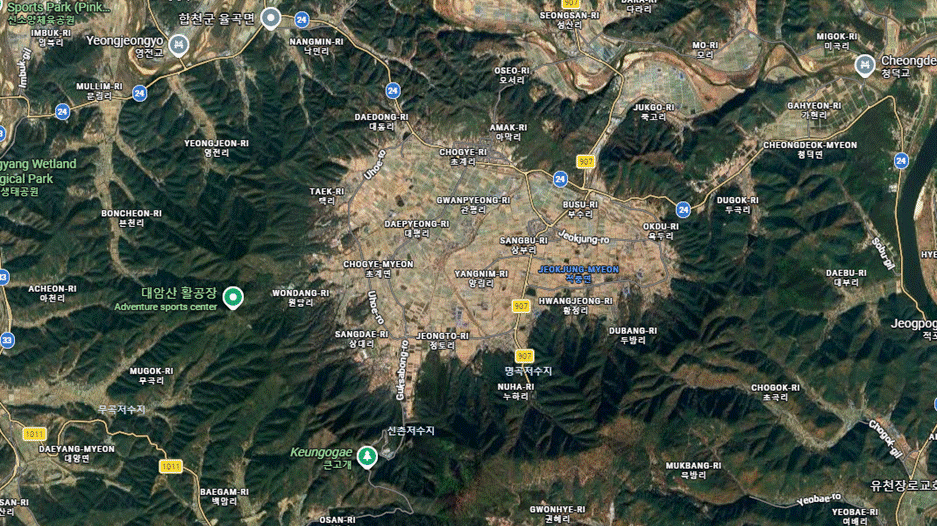
The crater sits in Hapcheon County, South Korea. If you were to stand on its floor today, you would have no idea you were inside an impact zone. You would see rice fields and vegetable plots, a small town off to one side, and a ring of green, forested hills around the edge. The basin is roughly ten kilometers across, and people have been farming this ground for a very long time. I could not find a firm figure for how long this particular site has been inhabited, but a conservative guess would put it at two to three thousand years of continuous human occupation.
The structure was only confirmed as a meteorite impact site in 2021, and in 2026 we learned a great deal more, because researchers drilled cores some three hundred feet down into the center of the basin and along its edges. Their findings appear in the journal Nature: Communications Earth and Environment, under the descriptive title “Discovery of stromatolite formation in post-impact hydrothermal lacustrine environments.” (Link: https://www.nature.com/articles/s43247-026-03206-7) That title alone tells you most of the story: a lake formed in the crater, the water was warm, and something remarkable grew in it.
Before accepting the impact interpretation, it is worth pausing on an obvious alternative. A roughly circular basin ringed by hills could also be a volcanic caldera, the collapsed remains of an ancient eruption that later filled with water and sediment. That hypothesis is easy to test and easy to discard here. The hills are made of Cretaceous and Mesozoic sedimentary rock, sandstones, shales, mudstones, and conglomerates, with some hard metamorphic rock beneath, and not the volcanic material a caldera would require. So we have to look instead for the positive signatures of an impact.
Those signatures are present. A high-velocity strike shatters rock and even shatters individual quartz crystals, and it melts the ground at the point of impact. The cores reveal melted rock beneath the basin where the surrounding cores show none, and below that lies fractured bedrock rather than any plume of hot material rising from deep within the Earth. There is also a gravity anomaly, a measurable change in the density of the crust, of exactly the kind an impact produces and a volcano does not. This is what scientists call a consilience of evidence, many independent lines all converging on the same conclusion.
And when did it happen? Radiometric dating of materials in the crater puts the impact at roughly 42,300 years ago. That is a strikingly precise figure, and it is worth noticing that it is not millions of years. By geological standards this is recent. It is also recent enough that there are no historical records, no local legend or lore, of an event that would have shaken the entire peninsula and thrown up an enormous dust cloud. People simply moved in much later and farmed the ground, entirely unaware of what lay beneath their feet.
Reading the Lake
Here is where the story becomes physically and geologically interesting. The impact melted rock to a depth of hundreds of meters and then buried that melt under a thick blanket of rubble that fell back into the bowl. Heat does not escape such a cap quickly. As rainwater collected in the basin, with no rivers able to drain into it over the high rim, the crater filled to become a lake, and that lake sat over a slowly cooling reservoir of impact heat. The result was a warm, hydrothermally fed body of fresh water, complete with bubbling inputs of warm water and sulfur, of a kind found nowhere else on the Korean peninsula.
The cores record the filling of that lake in patient detail. At the very bottom lies a hundred and fifty to two hundred feet of impact breccia, the jumbled, broken-up debris of the strike itself. Above that sits something quite different: well over a hundred meters, roughly three hundred feet, of fine lake sediment. These are clays and silts washed in through small streams, with the coarse material dropping out quickly and only the finest particles settling to the lake floor. They are thinly laminated, undisturbed, and appear to record seasonal couplets, not the chaotic dumping of a catastrophe.
That distinction matters, and it bears on the quantity of time involved. In crater lakes elsewhere in the world, places like Mono Lake with very limited sediment input, the center of the basin typically accumulates on the order of a single millimeter of sediment per year. When you have to stack up three hundred feet of fine, undisturbed, laminated material at anything resembling that rate, you are talking about a great many years. And critically, there is no large source for that sediment. A small catchment, a little pollen, the occasional leaf, some organic matter falling in. The lake had to fill slowly because there was simply not much to fill it with.
What the Stromatolites Record
Now to the most interesting discovery at the site, the stromatolites. A stromatolite is not itself an organism. It is a laminated, layered sedimentary structure built by communities of microbes, typically cyanobacteria, which are bacteria capable of photosynthesis. The microbes live as a thin film on the surface, trapping and binding tiny mineral grains from the water and gluing them together into a hard layer, then growing a new layer on top. Over time this produces a macroscopic object, some of these are twenty or thirty centimeters across, assembled grain by grain by organisms far too small to see.
Because they depend on photosynthetic bacteria, stromatolites can only grow in shallow, sunlit water. And here is the point that turns out to matter most: the water must be relatively clear and relatively calm. A turbid, turbulent, catastrophe-ridden lake would bury the bacterial film in sediment, block the light, and kill the colony. Stromatolites therefore grow only where conditions stay consistent, where the same shallow, clear, sunlit, warm water persists in the same place for hundreds and even thousands of years without major disruption.
They also grow slowly, something on the order of ten to one hundred micrometers per year, and they grow in layers that respond to the seasons, with phases of faster growth alternating with phases of near stasis. The consequence is that you can read a stromatolite much as you read a tree, counting its laminations and inferring the conditions under which each one formed. When researchers counted the laminations in these Korean stromatolites, some of the structures contained many thousands of individual couplets. Read in the ordinary way, that is thousands of years of growth, and just as importantly, thousands of years of stable, clear, shallow, warm-water habitat in a single place.
The internal record is even richer than a simple ring count. The couplets start out thicker and grow progressively thinner toward the outer, younger layers, exactly what you would predict as the impact heat dissipated and the lake gradually cooled over the millennia. Oxygen isotopes locked into the bacterial material track those same temperature changes independently. Rare elements, including osmium and the very rare earth element europium, were delivered by the impact itself and incorporated into the growing structures, which both confirms the impact origin and helps to date the layers. And radiocarbon dates taken from the inside of a stromatolite and from its outer edge bracket an interval that matches the number of rings counted in between. Several dating methods, in other words, converge on the same timelines, ranging well into the tens of thousands of years. If one wanted to insist that radiocarbon dating is simply bogus, one would still have to explain why a bogus method keeps producing ages that agree with the independent ring counts.
The Young-Earth Problem
So let me lay the young-earth story out as fairly as I can, and then follow its own logic. In the young-earth framework, nearly all of the sedimentary rock around the world was deposited by Noah’s Flood and then hardened into stone. The Cretaceous and Mesozoic sandstones, shales, and mudstones that make up the hills around this crater would be classified as flood rocks. But notice what that requires. Those layers were not only deposited, they were lithified into hard strata and then eroded into mountains, with the runoff of the receding flood carving out the valleys. The rock had to be hard when the asteroid struck, because the impact produced breccia and shattered bedrock, not a splash into soft mud. All of that has to be finished before the impact can occur.
That forces the young-earth chronology into a corner. The impact cannot belong to the Flood itself, since on this account the Flood is still busy making and hardening the surrounding rock. It has to be post-Flood. So in place of the conventional figure of 42,300 years, the most generous young-earth date would put the impact at the very tail end of the Flood, perhaps 4,350 years ago. Grant that most generous figure, and the problems begin to multiply.
Where does the water for the lake come from, if the global floodwaters are by then receding off the continents? Where does three hundred feet of fine sediment come from, when there is no significant source feeding the basin? And how, in only a few thousand years, do you fill a lake with hundreds of feet of sediment while simultaneously keeping its water clear and calm enough for stromatolites to photosynthesize along the shore for century after century? These two demands pull in opposite directions. Filling the lake quickly requires abundant sediment and turbid water. Growing the stromatolites requires clear water and minimal sediment settling on the colonies. You cannot satisfy both at once.
Even if you allowed the stromatolites to grow far faster than anyone has ever observed them grow, you would still need, at a bare minimum, something like five hundred years of stable lake conditions to build the larger structures, and that is already a faster pace than anyone knows to be possible. The honest figure is more likely several thousand years. Then you still have to fill the remainder of the lake with sediment that has no source, raise the surface high enough that evaporation finally outpaces input, let the basin pass through a long boggy stage rich in organic material, dry it out, and consolidate it firmly enough that a town and its buildings now sit on top. Each of these steps is being asked to happen inside a window that the evidence simply will not allow.
Catastrophe, and Then Patience
I want to be clear that part of this story is genuinely catastrophic, and that is exactly the point. The first hundred and fifty to two hundred feet at the bottom of the basin, the impact breccia, was emplaced almost instantly. Catastrophism is real, and some portions of the geological record are produced extremely quickly. But what sits above that breccia is the opposite kind of record entirely: fine, laminated lake sediment and slow-growing stromatolites that demand long stretches of calm, clear, stable conditions. A great deal can be made in an instant, and then a great deal more accumulates very slowly afterward. This is precisely the pattern we see in crater lakes all over the world, basins created in a moment that then sit quietly and gather sediment grain by grain for ages. They are a testimony to the slow, consistent operation of ordinary geological processes over time.
That is what makes this site such a clean example. The young-earth claim, repeated often, is that all the evidence points to a young earth, as though the conclusion were obvious to anyone who simply looked. But when you actually read the paper and follow the data, the site is very nearly void of explanatory power for a young-earth chronology. I have tried, and I have genuine trouble constructing even a hypothetical, ad hoc story that would let a young-earth creationist account for everything here at once: the hard pre-impact rock, the post-impact heat, the clear warm lake, the slowly accumulating sediment with no source, the eight thousand annual layers, and the multiple, mutually confirming dating methods. Snapping one’s fingers and saying the Flood did it does not survive contact with the details.
This crater in Korea was, for me, a delightful thing to stumble onto, and I find it especially intriguing precisely because, from a young-earth perspective, it would have to be a post-Flood impact. It is one more signature in the rocks that quietly insists it took time to form. We are still discovering impact sites on this planet, and I look forward to whatever the next ones turn out to teach us.
If you would like to see the cores, the laminations, and the figures from the paper for yourself, and to follow the reasoning in more detail than I can fit into a written post, I invite you to watch the full video on my YouTube channel.
Blessings, Joel
