There is a strange circular scar on the earth found amongst the meandering incised canyons of southeastern Utah. Called upheaval dome because it was originally thought to be the result of the slowing rising of a massive salt dome from below, this highly eroded structure has long been an oddity among the many spectacular sandstone cliff and horizontally layered rocks of the canyonlands region. Upheaval dome is part of Canyonlands National Park and the paving of the road to it has greatly increased its accessibility (it is only 42 miles from Moab, UT). This location was on my list of must-see geological attractions on our recent family vacation. Below I will take you a short tour of this unique attraction.
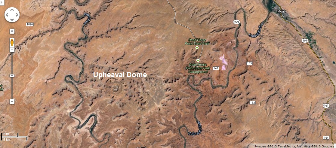
Above and below are Google maps screenshots of satellite images of Upheaval Dome. The image above shows the Canyonlands area with Moab to the right and the Colorado and Green rivers and they wind down to their confluence just below the bottom of this image. Upheaveal Dome is that circular structure which you can see in more detail below.
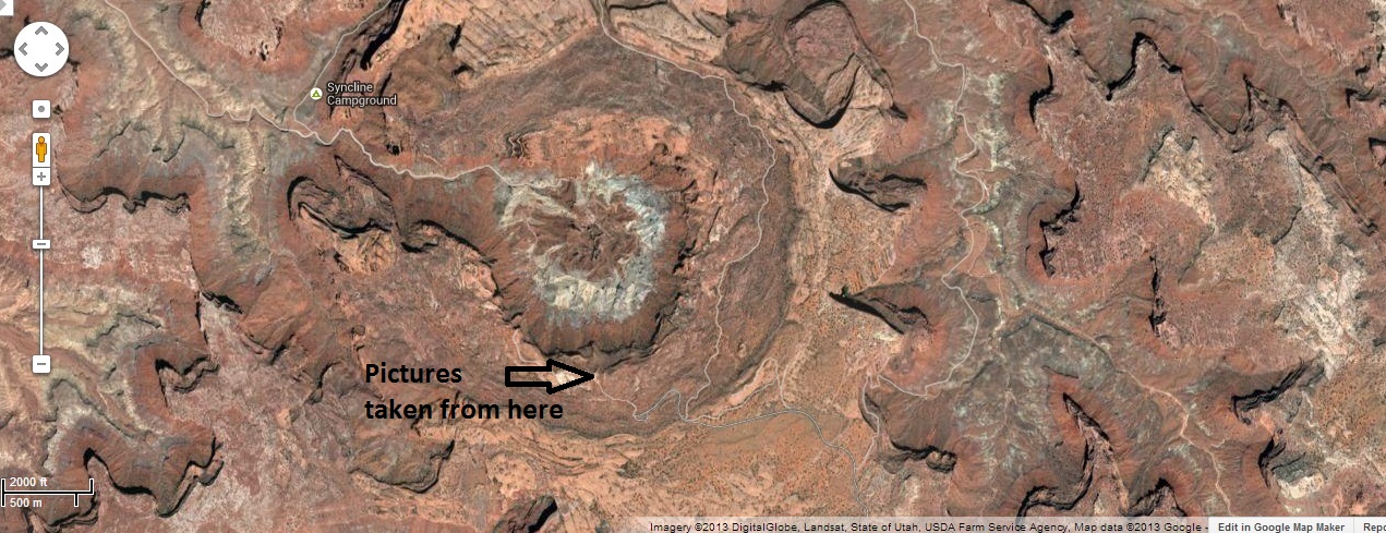
Above we see this odd feature a bit closer. The dome region is just over 3 miles wide. There is a paved road leading to the base of the rim of the dome/crater. A parking lot with facilities is present and from there it is a 1/2 mile walk up to the edge of the rim. Below is a picture I took on my hike to the rim though this one is looking back down toward the depression where the parking lot can be found. This rock is all bent up at a 45 degree or so angle which contrasts to the plateau we had driven across for the last 20 miles to read this location. Suddenly there is a rise and the rocks start lifting up and then much more suddenly from the parking lot. This is such a contrast to the hundreds of square miles around this spot where the rocks layers are all horizontal to slightly dipping but right at upheaval dome the sandstone rock is tipped up at the “rim” to nearly 90 degrees.

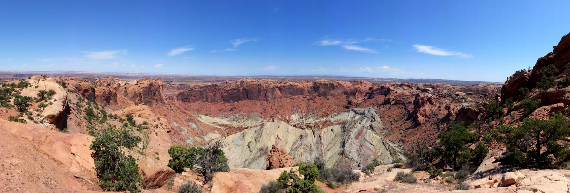
After a short but tiring walk up the steep sides of the rim you are rewarded with this amazing scene from the rim of the crater. After seeing the layered pancake rocks of the rest of the Canyonlands this sticks out as really being different.
A meteorite impact site:
Below is a picture of the interpretive sign at the first overlook at the rim. I don’t know how long the sign has been there but it is a bit out of date now. The sign portrays the origins of the place to be a mystery and presents two alternative hypotheses. The impact theory and the salt dome theory have been debated by scientists for 20 years but in the past 5 years that debate seems to be over as there is very strong evidence (shocked quartz crystals and other recent findings) for the impact theory. I would think that it would be fairly safe to simply say this is meteorite impact site though one that has been highly distorted over time.

Below are two more images of what I will now call a crater. This crater is not what you might expect. There is a large mound in the center. The idea here is that this is a very very old crater. One that was caused by a meteorite impact after the thick sandstone layers were laid down but then this entire area was covered by additional rock which has since eroded revealing this former scar on the earth.
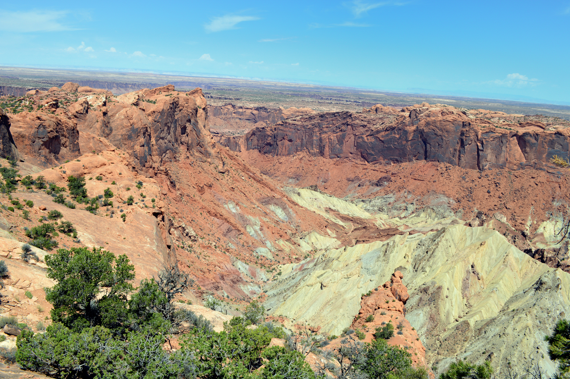

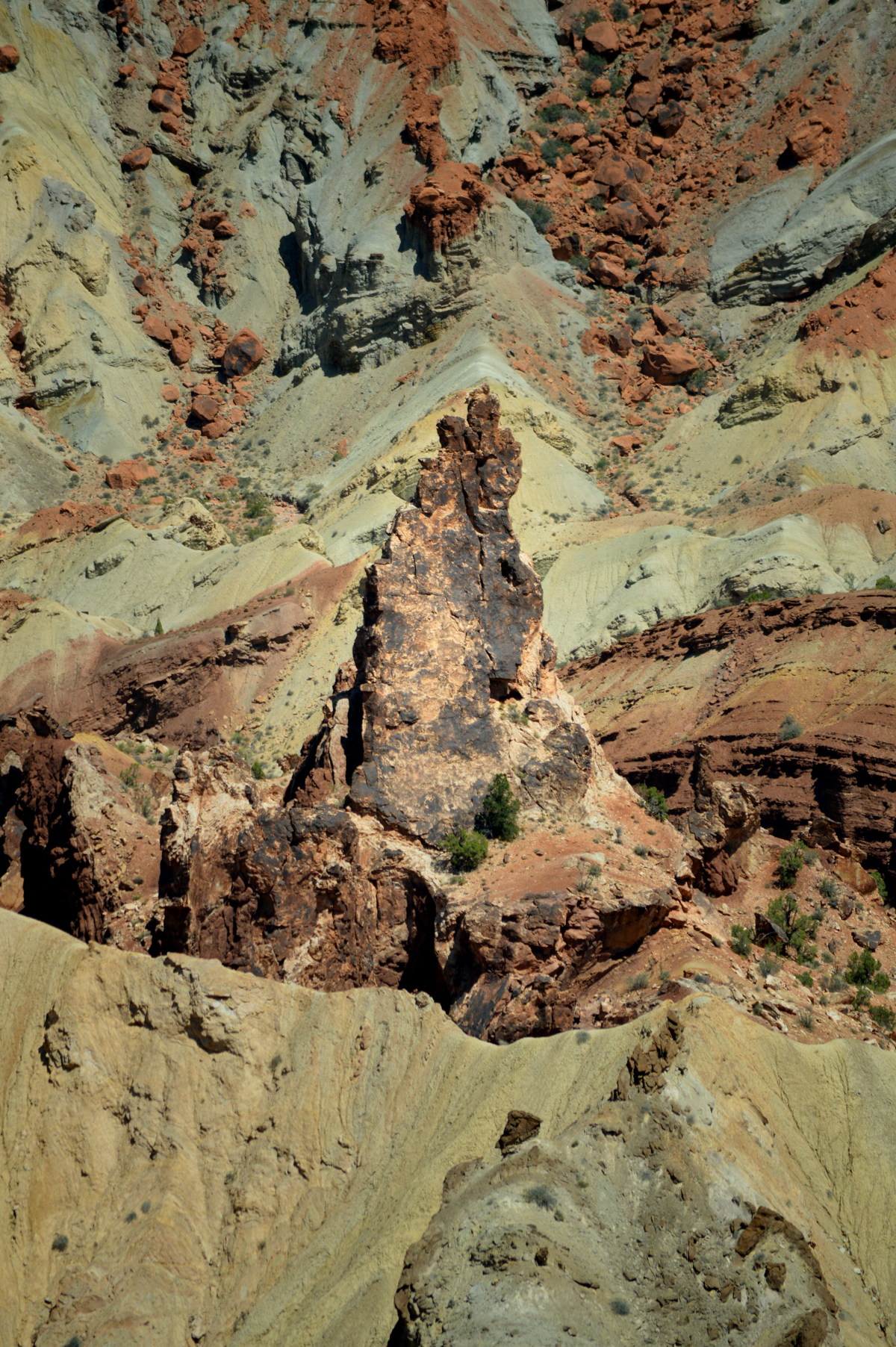
Below is a close-up of the mound in the center and a rock spire that rises up out of it. You can think of the center as a tear-drop formation when large object strikes the ground is forms a huge hole but there is a bound back like a drop of water landing in a pool. That bounce back in the middle pulls up rock from below. This older rock is now exposed after the other material that filled this crater has eroded out.
Most people think of Meteorite Crater in Arizona (see below) when they think about how a crater should look. That crater is much smaller (less than 1 mile in diameter) and so the forces of impact would have been much less. That crater is also been dated to be much younger, a very young 50,000 years, and so has not eroded much in the desert environment. Upheaval dome is estimated to be some 170 million years and is believed to have been completely buried until the time of the formation of the canyons in the Canyonlands region much later.

