What museum can you go to where you can see real dinosaur bones, you don’t pay any fees, you can touch all the exhibits and there are no security cameras watching your every move (at least I don’t think there are:-)? The answer is The Mill Canyon Dinosaur Trail near Moab, Utah. This outdoor “museum” is maintained by the Bureau of Land Management and is completely open to the public. There is a parking lot, a couple in interpretive signs and registry for you to document your presence. Don’t expect a visitors center, snack shop or even a “deep hole” outhouse. This is a little known site that is only 15 miles from the entrance to Arches National Park. While there are thousands of people at Arches on any single day in the summer there are likely many fewer than 50 people who experience the dinosaur trail on any day. But there are dinosaur bones, and lots of them, sticking out of the rocks along a thin section of a small ridge. Below I take you on a tour of the 1/2 mile Dinosaur Trail of Mill Canyon and give you my own version of an interpretive talk. It is just a half mile and you don’t have to work up a sweat in the 90+ degree heat that is common at this location (even if it is a “dry heat”). Of course you won’t be able to actually touch the dinosaur bones and the pictures really can’t do justice to any location in Utah as the sky and the rocks are so big there.
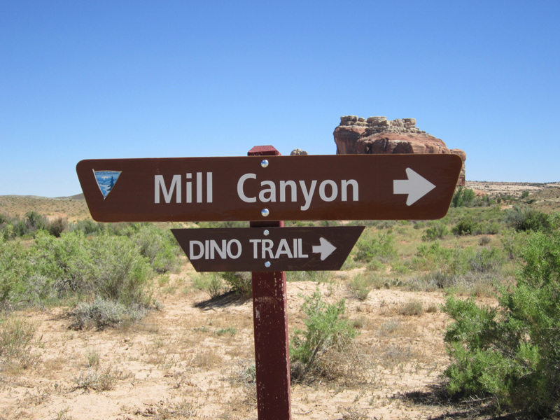
Let’s start the tour with an overview of where the dinosaur trail is located and then we will take our short walk.

Above we have a satellite map from Google maps showing the general area. Mill Canyon is the name of a valley carved out of large section of sandstone rock that dominates the Moab area. Arches and slickrocks over Moab are mostly from this formation and it these white sandstones in which the arches of this region are formed. The dinosaur trail goes from the parking lot along a small ridge almost down to the mouth of Mill Canyon. Moab is 15 miles to the south along route 191. Below is the view looking from the parking lot into the Mill Canyon. I also have a brochure from the BLM that describes the location and fossils that can be observed there.
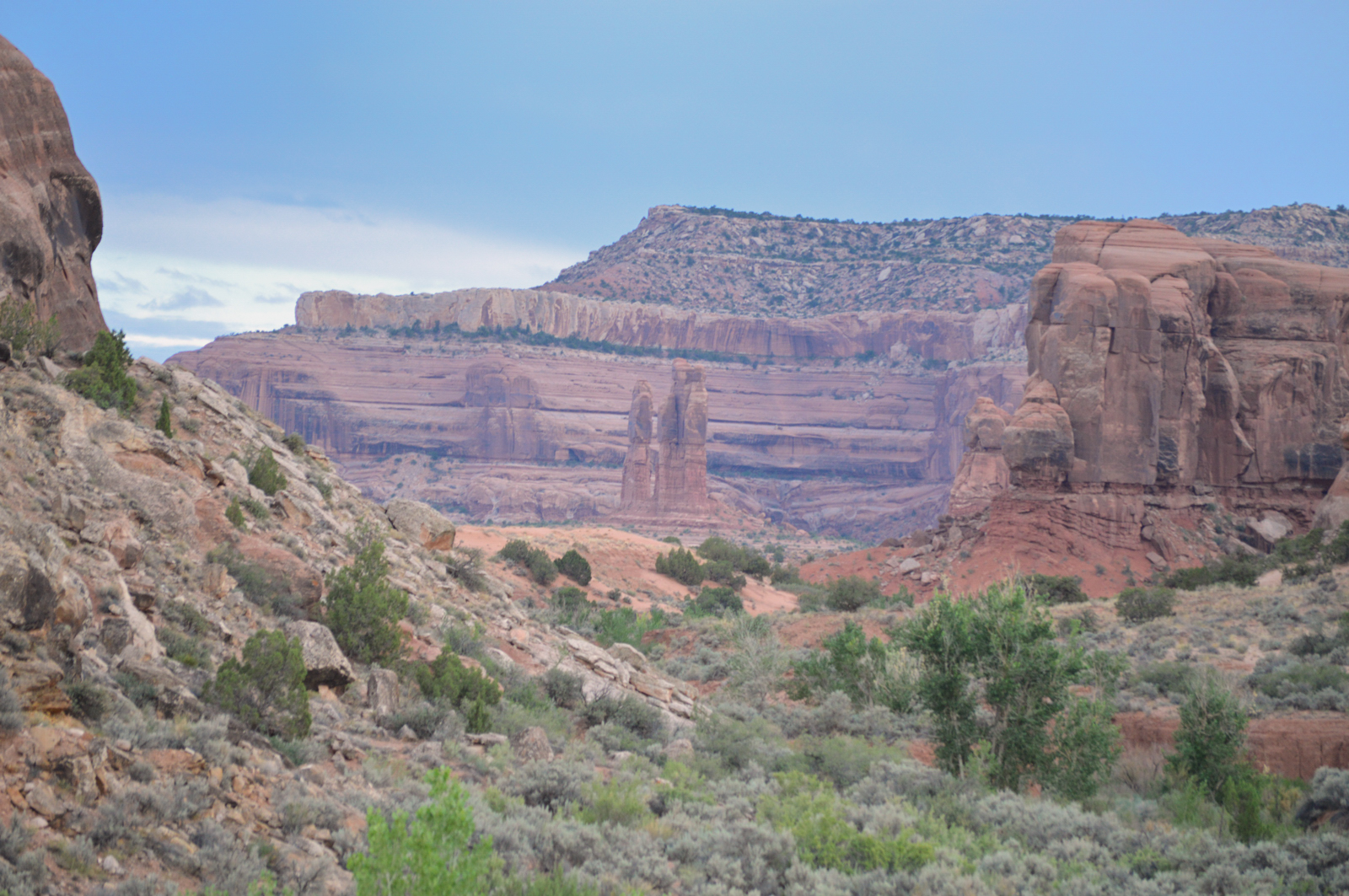
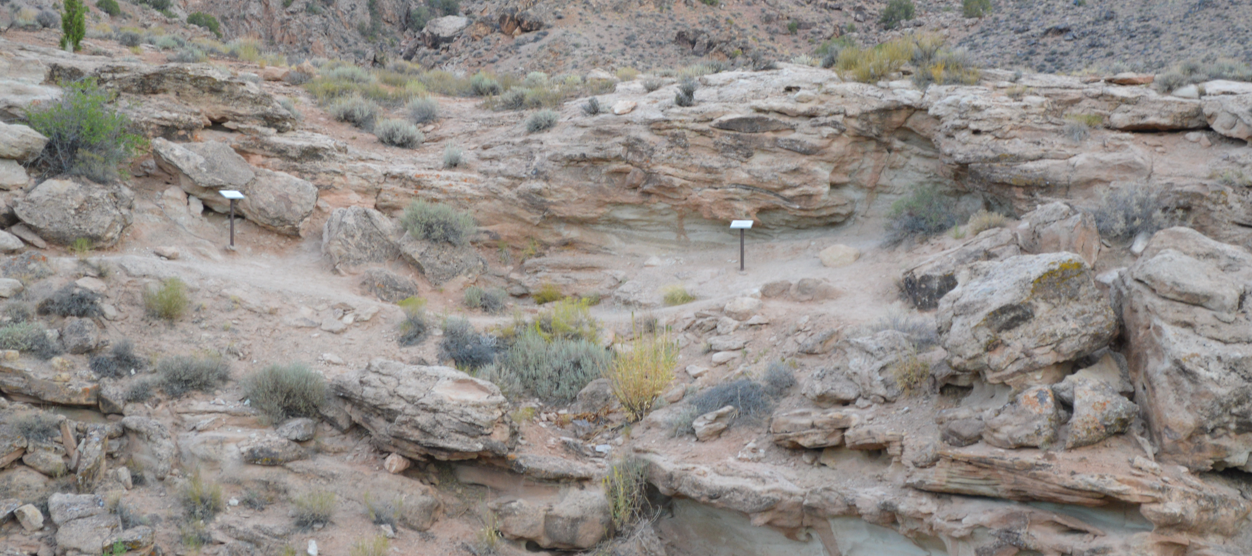
From the parking you look across the small dry creek coming out of Mill Canyon to a small ridge on the other side and you can see the trail along the ridge with a few scattered signs in front of notable fossils.
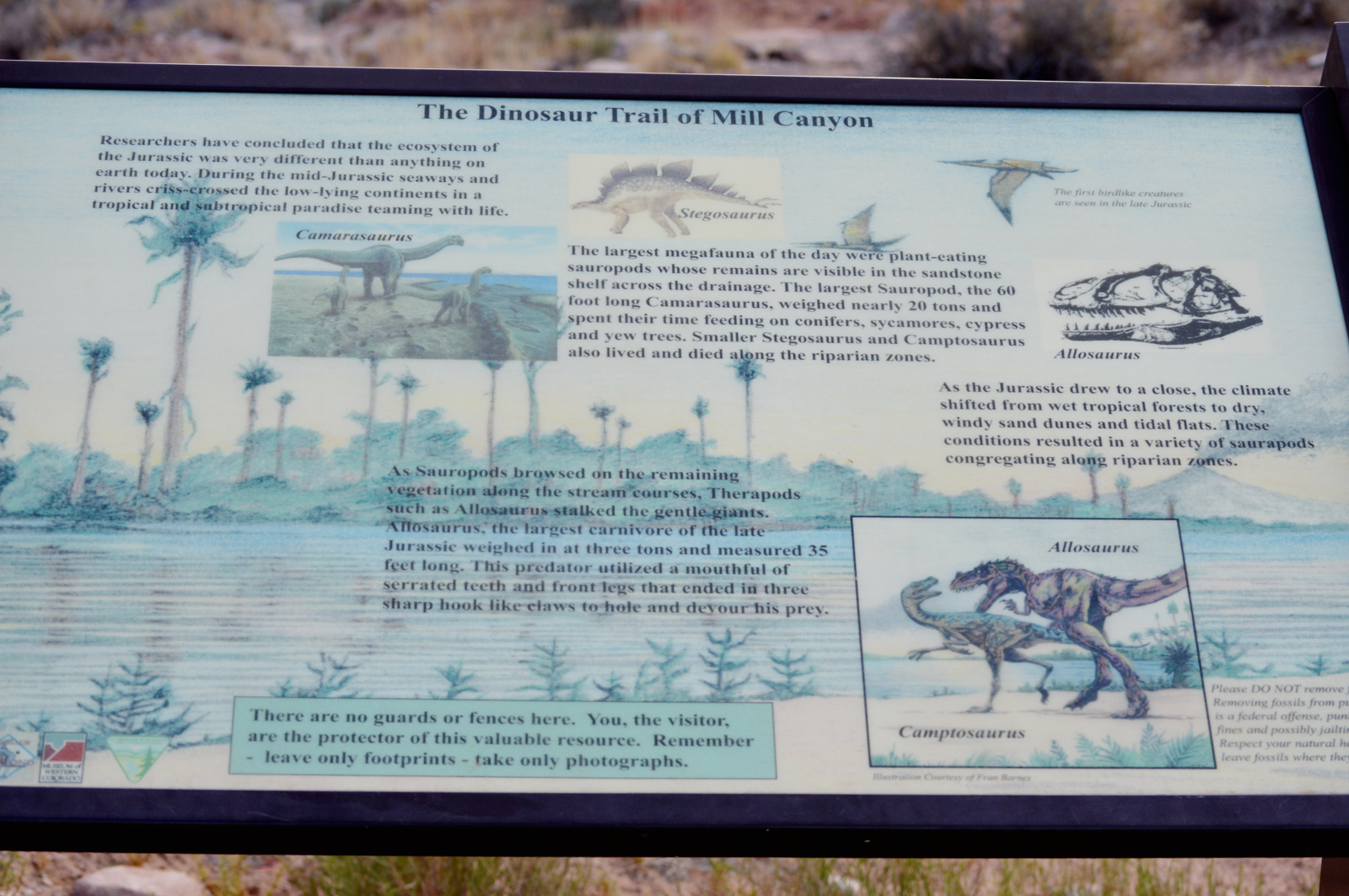
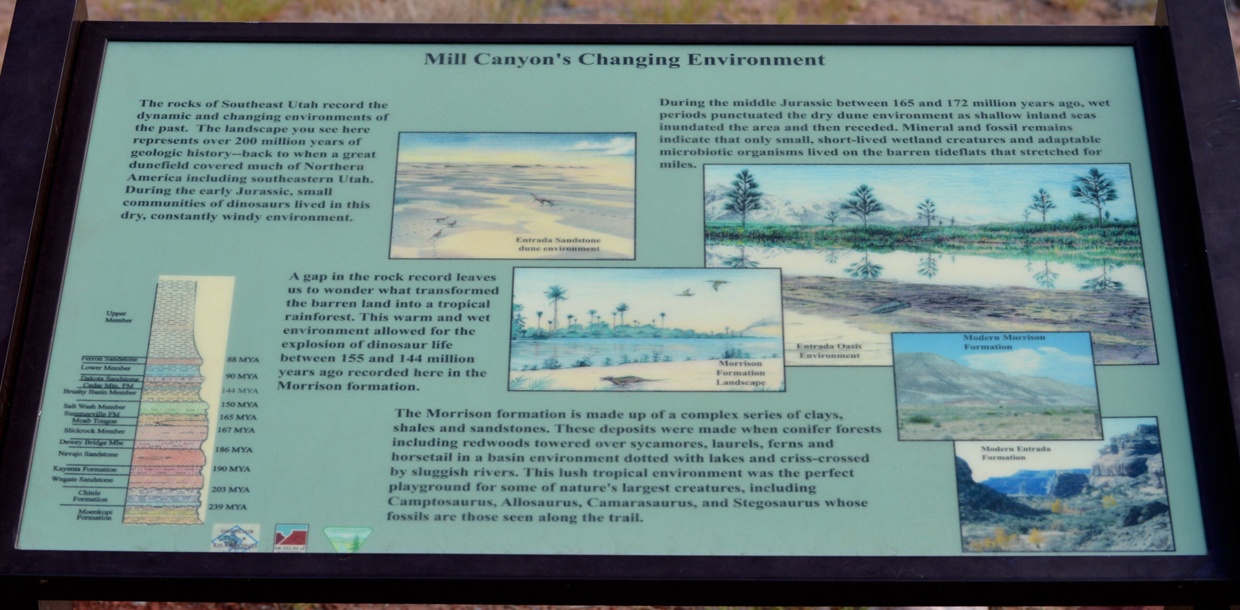
As you leave the parking lot and go onto the trail there two larger interpretive signs. One presents an overview of the dinosaurs whose bone are found at this site (below) and second there is a sign that presents a geological and ecological interpretation of the area.
When we reach the ridge you will immediately start to see parts of dinosaur bones. At first it may not be apparent that these are bones. It is likely that walking anywhere else if you were to come by rocks that looked like this you would not immediately suspect you were seeing dinosaur bones. There was a sign there to direct us to what we should see. One we looked closer we realized that this purple-tinged rock had a texture that was very different from the other rock (see below for several examples) that it was embedded in. Once we knew what we were looking at my kids starting seeing pieces of dinosaur bone all over the place.

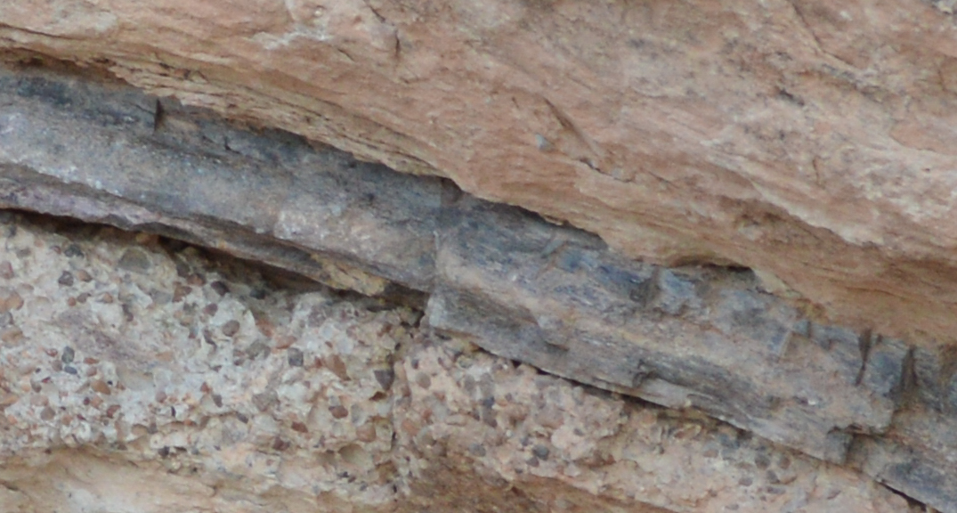
Many people envision dinosaur bones as harder than the surrounding rock and thus separating from the rock matrix so that the bones are easy to identify. This is not always, and probably not even commonly, the case. Here the bones are rock and they are embedded in solid rock. There isn’t much danger of someone taking off with these bones! Below are a few bones that are more easily identifiable as distinct from the other rock matrix.

In the case of the broken femur above you can see an outer ring of darker rock with the inner lighter rock representing the inner bone which would have had a different composition and fossilized differently.

Above is a close up of a portion of the visible scapula bone. This shows the matrix of rock that this bone was embedded. At the time the bone was covered with sediment these sediments were mostly small river stone (about the size of pea gravel). You can see the rocks in the layer just below this scapula (there is a rib bone just out of sight below this image) are pea gravel with a matrix of fine sand in between while the rock above the scapula is made of primarily sand. All of this is now solid rock and we call this kind of rock which is composed of many other smaller rocks conglomerate because it is a conglomeration of many different things.
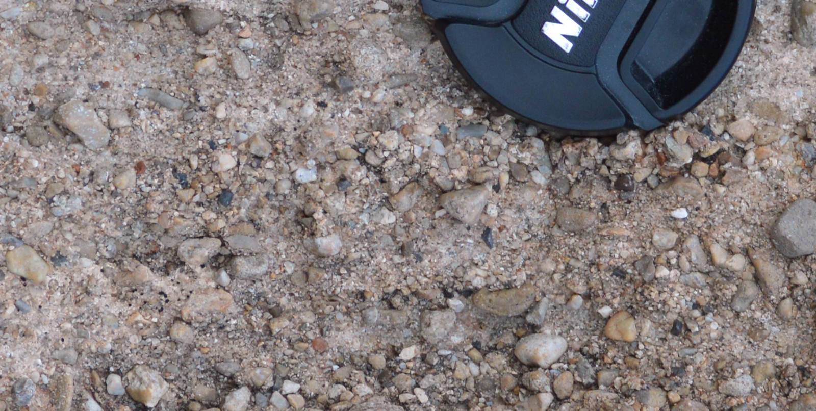
Above is another example of the conglomerate that is the common matrix in which these dinosaur bones and other plant fossils are found. You can see that the different colors of these rocks tells you that they have been transported here from many sources. They are smooth because they were formed in stream beds and this very place was then a stream bed where these gravels came to lie possibly during a storm. Those same water that brought these rocks here likely dragged these dinosaur bones into this same place. None of the bones here are found connected to any other bones. These are an assortment of bones from several different dinosaurs found here. They likely didn’t die on this spot but died in the area and decayed and/or eaten and torn apart and then those bones were washed into this spot and covered by more gravel and then finer sediments and preserved.

Not only are there dinosaur bones at this location but there are petrified trees and other plant remains. Above is one very large petrified tree trunk. This came from an aracalia-type tree which is a very primitive conifer (pine-like) tree that is extinct today. This tree trunk is also preserved in the same matrix of gravel turned to stone (see below for a closeup). Like the dinosaur bones, trees were probably swept downstream and also ended up in this same area.
I should point out the dinosaur and tree fossils are found very locally meaning that there is a thin (several feet thick) band of rock in which all of these are found and it you go horizontally too far they become very scarce and if you look in the layers above and below there are none to be found. This favors an interpretation that this was a stream bed that one particular time had the right event (big storm or tsunami if this was a coastal region at the time) that washed these items into this place but usually the environment was not conducive to fossilization.
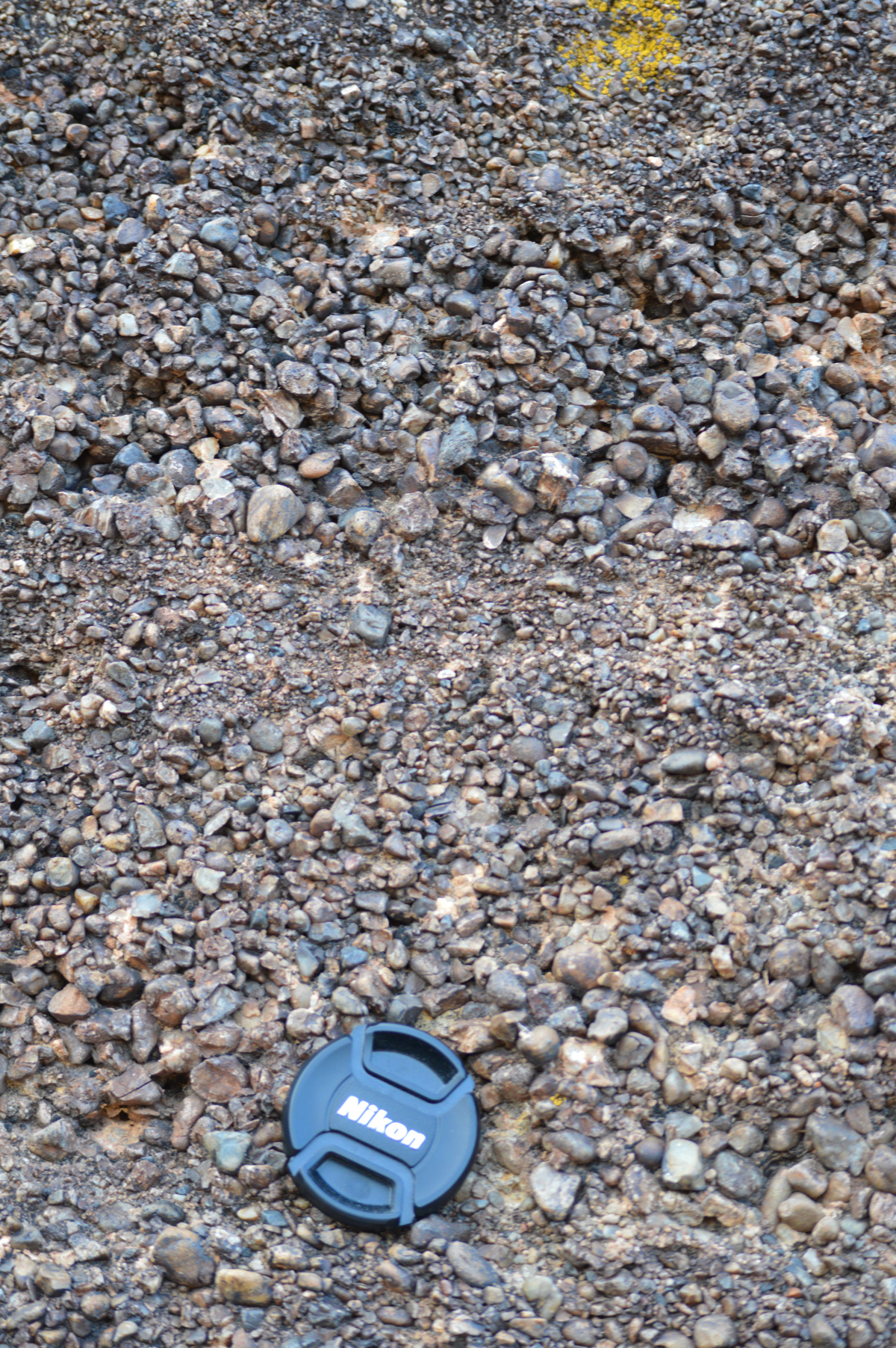
Above is an example of the stream bed gravels that are preserved in this area. Notice that the pebbles are sorted based on size and presumably weight. This suggests water that is flowing at different rates over time. Above this rock used to be hundreds of feet of wingate sandstone which is fine-grained sand that was probably blown in drifts. That sand can be interpreted as large sand dunes that covered this entire area after the climate changed and the streams dried up.

Above is a nice example of a leg bone of a large dinosaur. One that was clear from these bone was that despite the reports that some bones can contain only partially fossilized tissues in the inner bone these bones were clearly 100% mineral in composition. What at one time was inner bone is recognizable because the rock is a different color but it is rock nonetheless.
Below shows the context again of where these bones are found. In this picture you can see where the dinosaur trail runs and there is a sign in front of a dinosaur bone. These bones are in the stream bed rock found in the bottom portion of that thick block of rock on top and just below it. In the upper portions of this rock the sediments get finer and there are no fossils. This suggests that the are experienced different conditions over time. Dinosaur fossils are scarce to non-existent in the layers above and below this stream bed deposit.
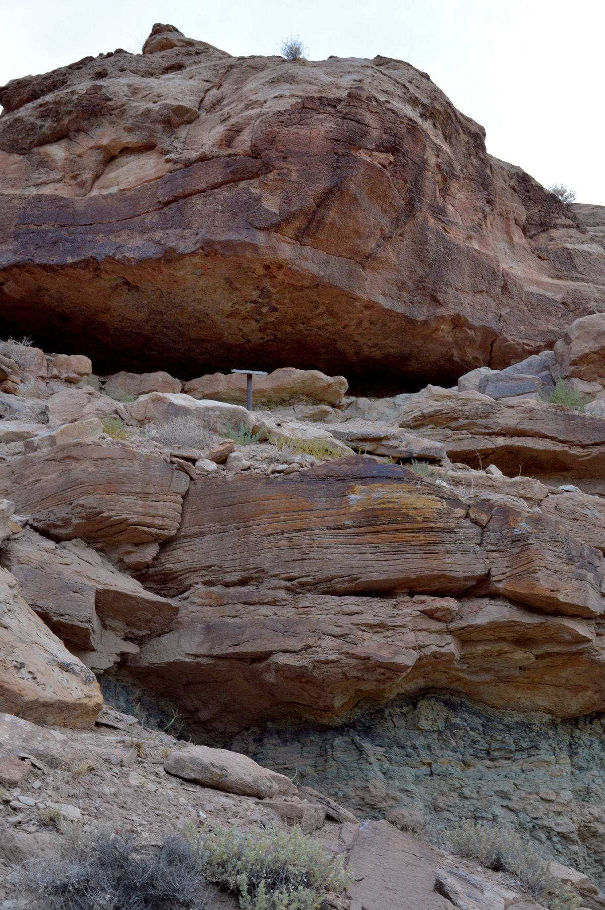

Let me remind you where Mill Canyon lies in the bigger geological scheme of things. This small ridge only appears here now because several hundred feet of sandstone above this area has been eroded away revealing this rock. But even these rocks that bare the dinosaur bones sit on top of 10s of thousands of feet of sedimentary rock. As a reminder of just how much rock look at the pictures below from 100 miles south of this point. This rock in the left corner represents rocks of about the same formation as we see at this dinosaur trail. Now look down at more than 2000 feet of sedimentary layers of rock. Then imagine that even at the bottom of this canyon you are just entering into the rocks that are at the top of the Grand Canyon and go down another 4 to 5 thousand feet until you hit granites that represent the ancient crust of the earth.

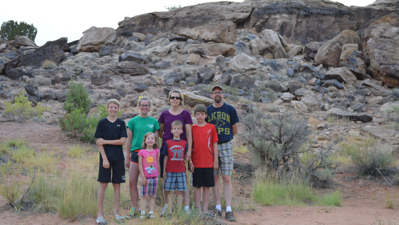
We had a good time on the dinosaur trail. I was surprised how impressed the kids were with the bones despite the fact that none of them could be seen whole because they were embedded in the rock. I spent some time looking at boulders that had fallen down into the small valley from this ridge and I could see hundreds of fragments of bone every time I spotted a rock that had the same cemented gravel appearance.

Hi Joel,
My boy, my husband and I, did that trail last week. Very descriptive article and pictures. Reading it is like we ware there again. Thank you very much.
Best regard.
LikeLike
Thanks, I wish I could get out there again soon. Joel
LikeLike
That was helpful we just spent a day farther north outside of green river called fossil point. Some amazing bones there as well!
LikeLike
Wonderful report. Thank you for taking the time.
LikeLike