It is cold and snowing outside and it is supposed to get much colder. I feel so far away from when I was standing at the overlook of the Goosnecks of the San Juan River in 99 degree heat taking in the desert southwest. Six month later I’m still sorting through my pictures from our family vacation to southern Colorado and Utah. I have shared some stories of specific geological features before (A Tour of Dinosaur Trail, Goosenecks of the San Juan River, Petrified Sand Dunes, Upheaval Dome) but today and in second round I want to just share some of additional favorite pictures of places from southeast Utah.
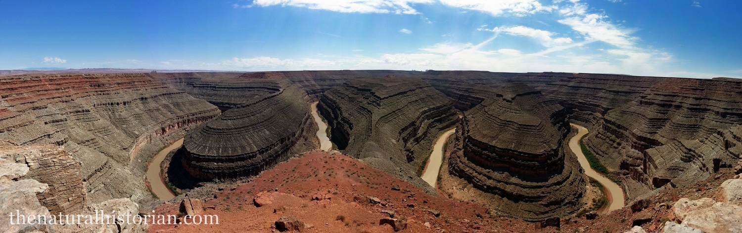
I’ll start out the tour of sites from my recent trip to Utah with a classic picture. You can find hundreds of pictures taken from the same spot on Google but there can’t be enough of this simply spectacular display of erosion through hundreds of layers of sedimentary rock in southeastern Utah. I took this unedited panorama with my camera phone (Galaxy S4). The phone came in handy a few times on the trip especially for these large shots that I wasn’t able to take with my Nikon 3100.
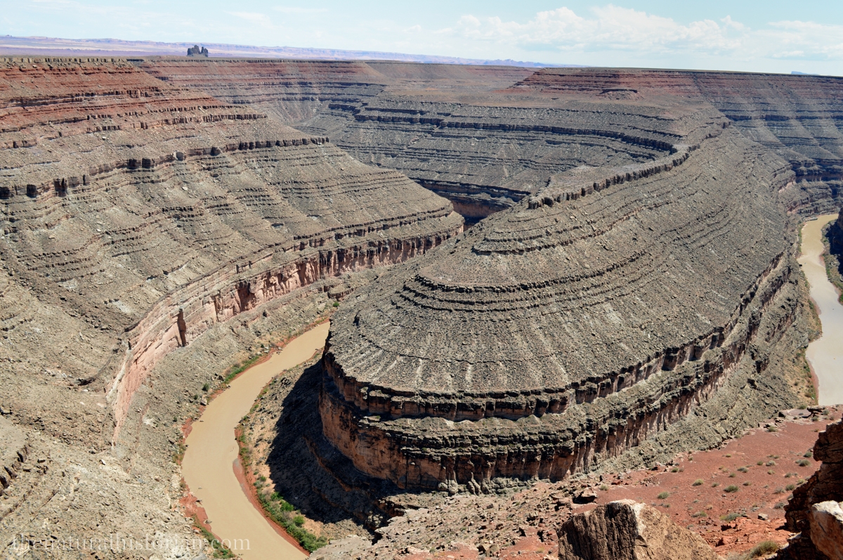
A more detailed shot of just a portion of the sedimentary layers that the San Juan River has cut through on its way to meeting up with the Colorado River.

Standing at the intersection of SR261 and US Highway 163 in southeastern Utah near Mexican Hat is an awesome display of geology. All around are layers of rock of different colors and orientations. The most spectacular are looking straight to the east as in the picture above. Here we can see what is called the Raplee Anticline which is a massive bending of the hundreds of feet of layers sediments.

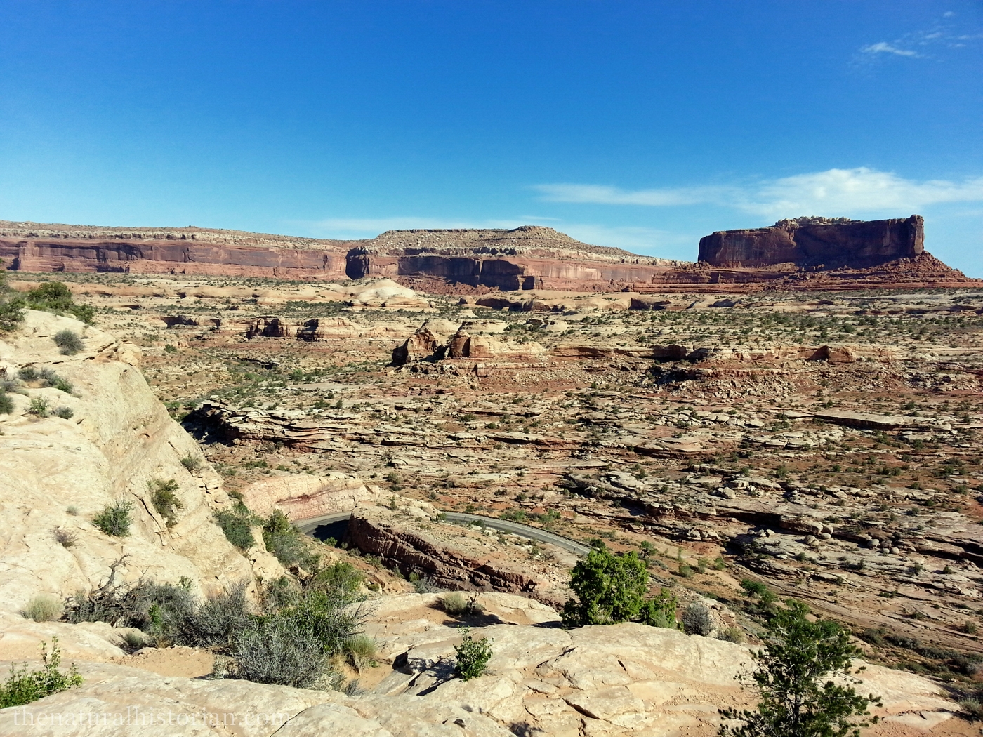
After leaving Goosenecks of the San Juan River State Park we got back on state route 121 and headed west. Suddenly you come to a massive set of rocks and you are lead through a series of switchbacks up more than 500 feet. It was 99 degrees at the Goosenecks but in a matter of a few minutes we were much higher and the temp dropped to a pleasant 90 degrees. On this higher plateau is juniper/sagebrush vegetation that is like the high desert region that I talk about in the pictures below from Colorado.

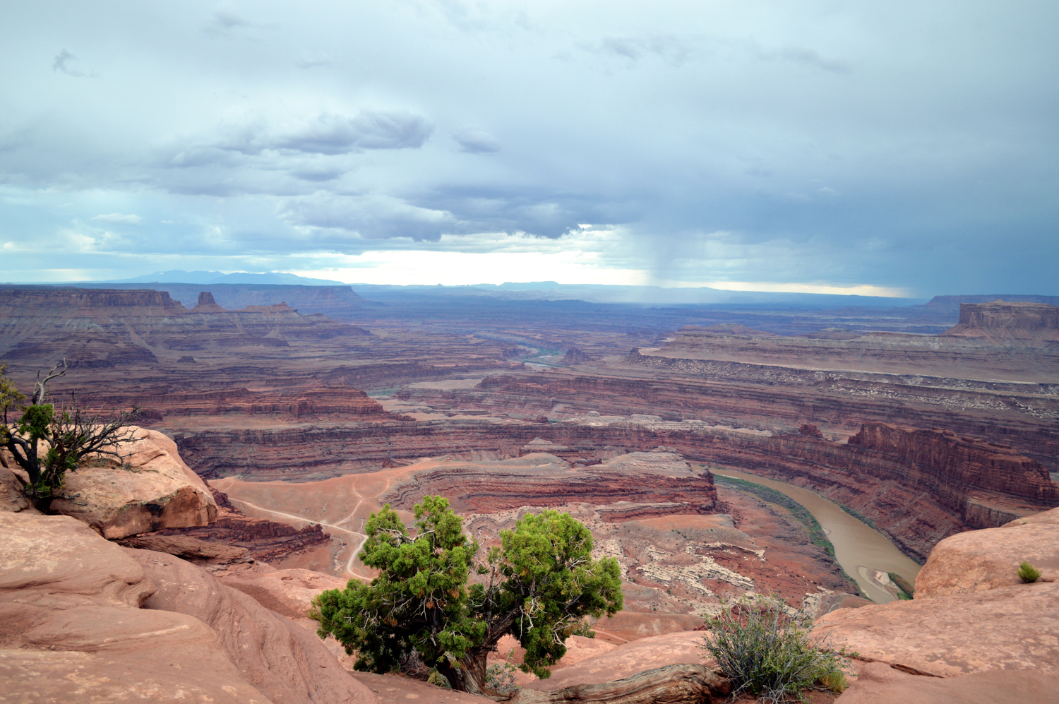
Leaving SR121 we drove down Mulie Point Road, a dirt road that felt like washboard. At the very end of the road you find yourself at the tip of a plateau looking out over the goosenecks region of the San Juan River. In amazing view of carved canyons as far as the eye can see.
Below: From Moab UT we visited Canyonlands National Park, Arches National Park and Dead Horse Point State Park all of which are within an hours drive of Moab.
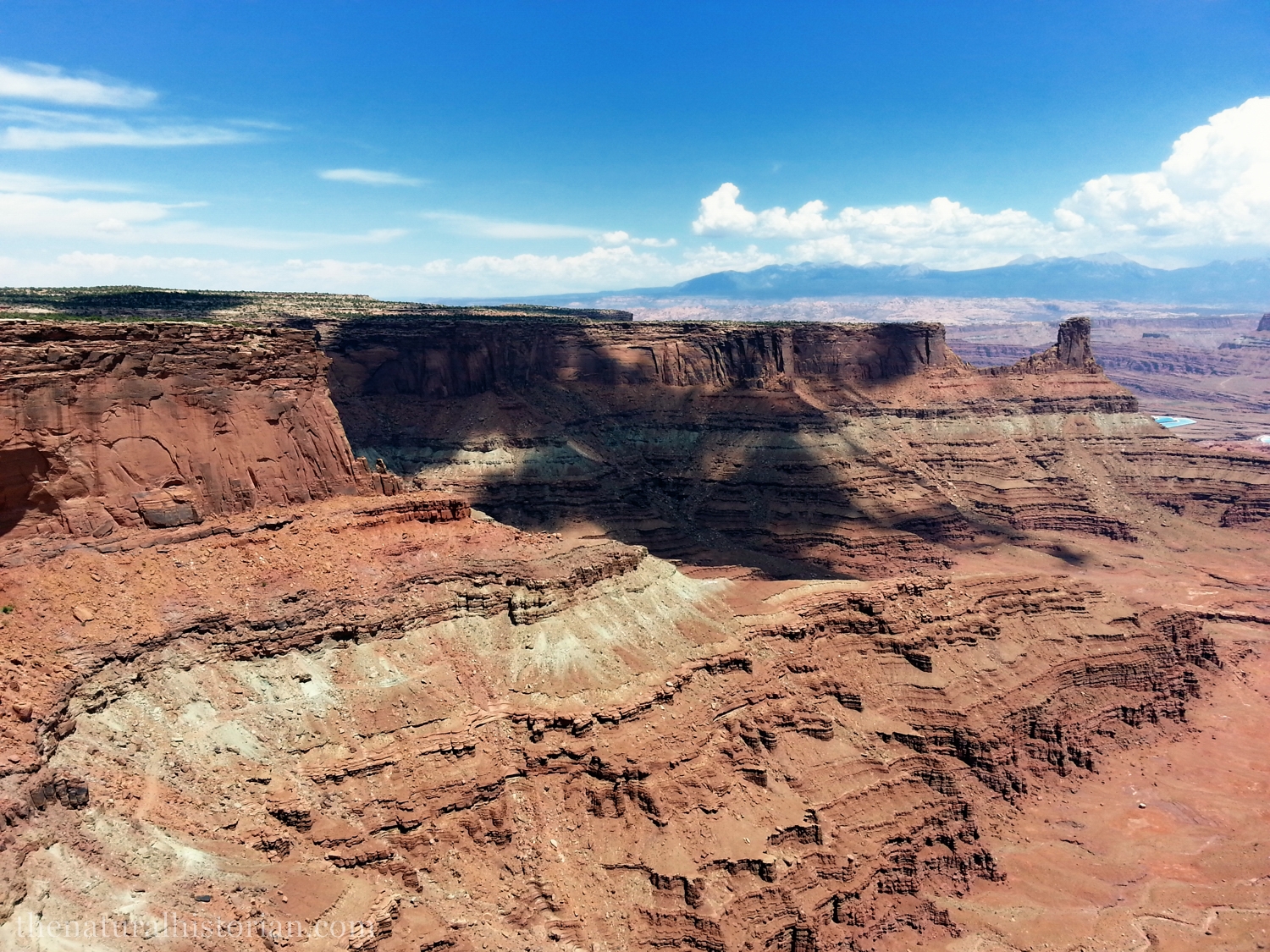

The Shafer trail is a slightly improved dirt road that makes its way around a rock rim that is below the upper plateau but still above the final canyon leading down to the Colorado River. The first part of the trail, which is quite well-known, takes this very steep set of switch-backs to go from the upper plateau down to the lower rim about 500 feet below.

In Canyonlands National Park there is a particular formation called Upheaval Dome. Previously thought to be a salt dome it is now thought to be the result of a large meteorite impact. I explored the origins of this site in my detail in my post: Upheaval Dome: Canyonlands National Park.
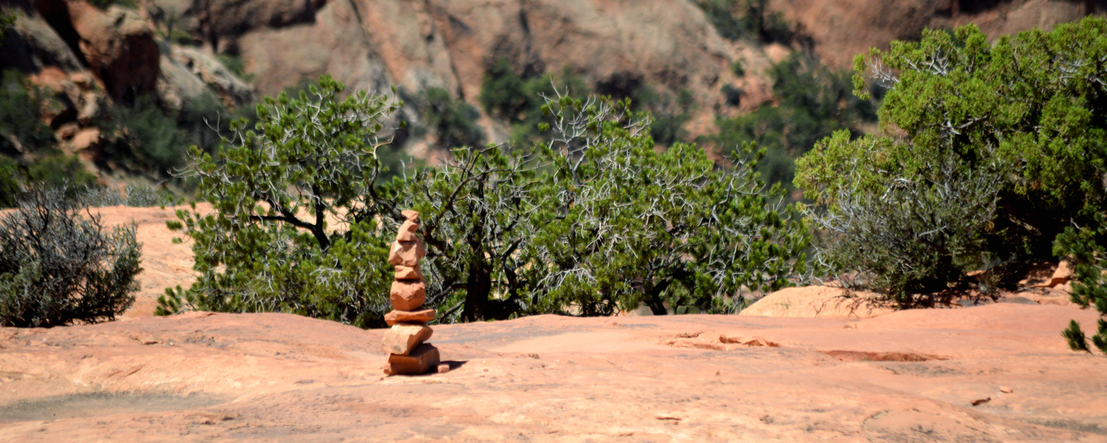
Hikers in the southwest are familiar with these little piles of stones that mark the trail. I took a picture of this one because I liked the contrast with the green junipers and sandstone right at the top of the Upheaval Dome trail. I also had witnessed a kid probably 10 to 12 years old had knocked this pile over about 20 minutes before. He seemed to think it was funny and his parents didn’t really seem to indicate they cared. Maybe they just thought it was the result of another kids goofing around but a few minutes later I witnessed a Park Ranger stack these rocks back up. That pretty much shattered any remaining idealism I had about the position of Park Ranger. I image they must spend many hour stacking these rocks only to watch kids kick them down.
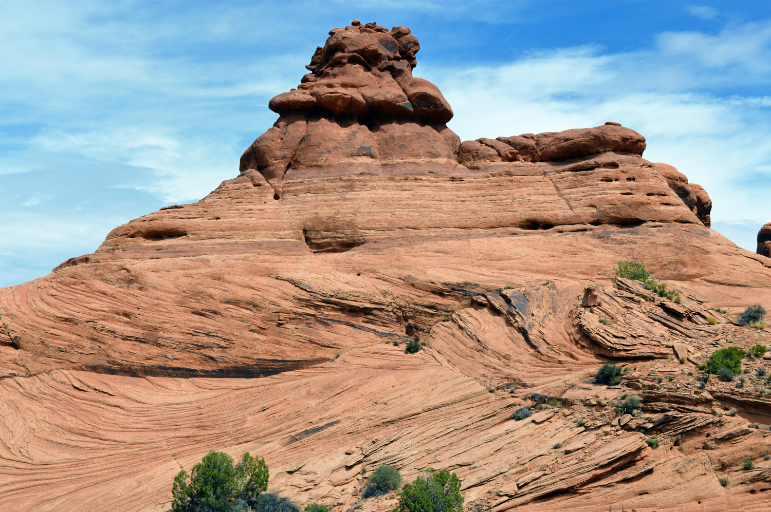
I have a whole series of pictures of the petrified sand dunes in a separate post: NH Photography: Petrified Sand Dunes

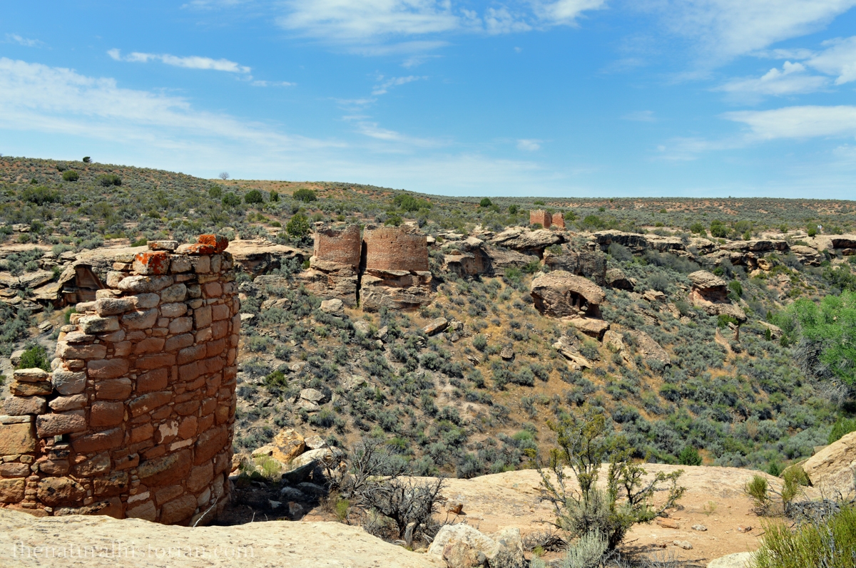
Rather than visit the more famous Mesa Verde we went far off the beaten path to visit Hovenweep National Monument where a number of valleys are ringed with some well-preserved stone buildings. Ancestral Puebloans lived here up until 1200 or 1300 AD having come to this area about 500 AD. It is hard to imagine as many as 2500 people living in this valley. The land today would be hard pressed to support anyone and yet there was a thriving agricultural based community here. The climate in the past was wetter as evidenced by the types of plants remains that have been found here

Athough this was late July it was only in the low 80s just before noon when we visted. Hovenweep is found in the “high desert” when lies at the foothills of the Colorado Rocky Mountains. The high desert in this area is sprinkled with the grayish colored sagebrush and the green junipers. During the time this area was occupied it must have been a bit cooler and wetter allowing for some growing season of grains and vegetables and thus this area probably looked quite different.
As an aside, one thing that always strikes me about the western US is that the very real effects of climate changes are so obvious there. Right here people made a living off the land less than 1000 years ago and yet today that same culture could not survive here due to shifts in climatic patterns.
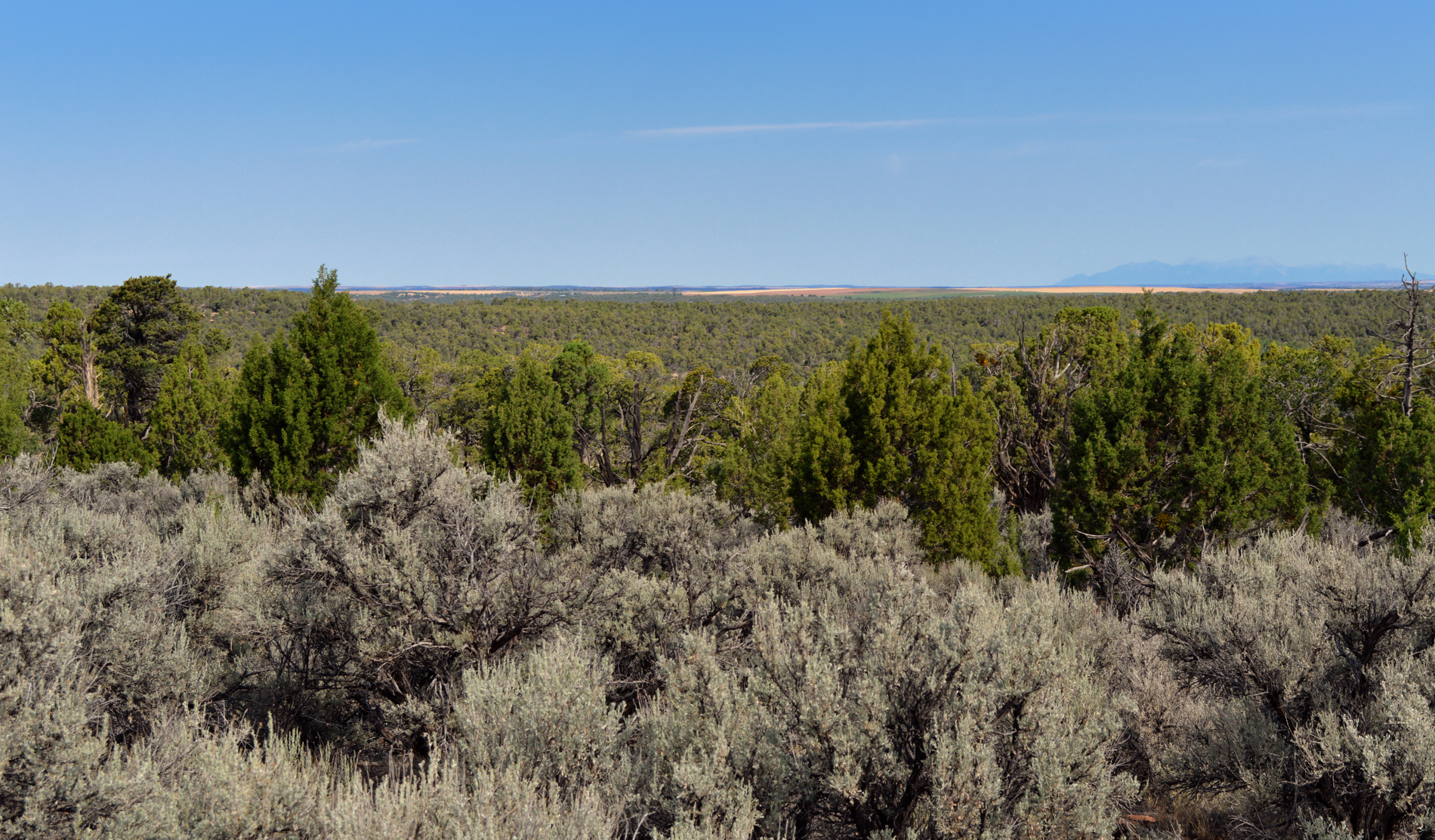
Above is a very simply photo but I just loved the look of the place. The blue-gray sagebrush has that great scent which combines with the juniper bush smell as an unmistakable smell of the high deserts of the southwest. I like the three color tones (gray, green and blue) in this picture. It seemed that at the Lowry Pueobloan ruins that every way I turned I was faced with the same color scheme.
