
This summer two of my sons and I took a hike through the Jurassic time period. Near Greybull, Wyoming is a long ridge called Sheep Mountain. Geologically speaking, Sheep Mountain is an anticline which is a type of folded bedrock that has an arch-like shape with its oldest rocks at its core. Because what are typically horizontal rock layers are here found tipped up and eroded what we were able to do as we hiked up the mountain was go through successively older layers of rock: we were hiking back through time.
Today I am going to share a few pictures of our hike and then highlight one stop along our time-traveling adventure. That stop is in the Jurassic time period when this region was part of a shallow sea. We know that because of the type of fossils contained in the rocks that formed at that time. We did see many of these fossils and I am going to show you just were we found them.
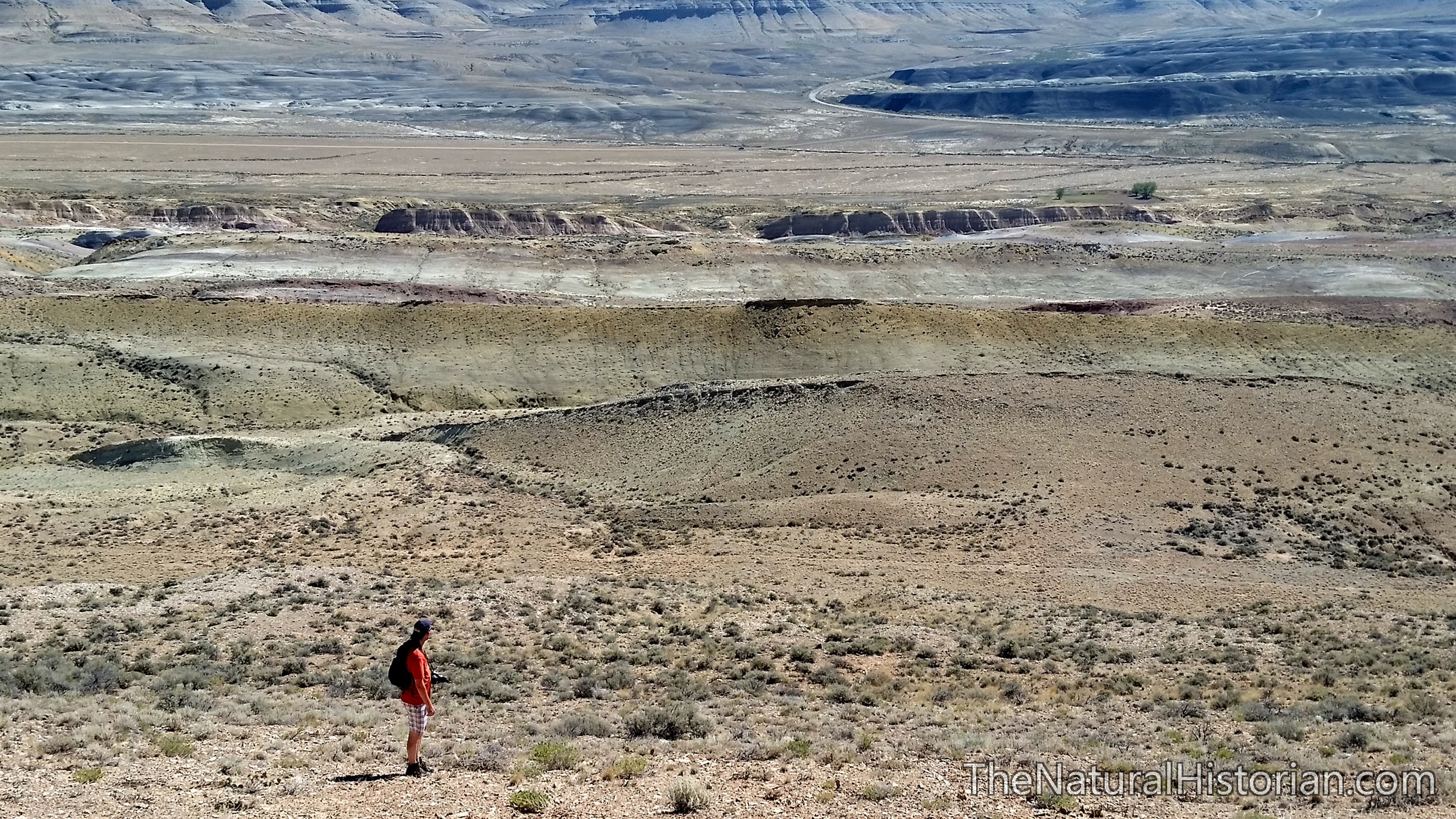 That is me looking back over where we have climbed for the past hour. Our car is on the side of the road middle/upper-center of this image and only visible if you click on the picture to get the larger version. Each step I take I am stepping further back in time. Each ridge you see in the distance represents unevenly eroded layers or rock. Some layers are harder than others causing them to resist erosion and these form the ridges. On the flanks of the middle ridge in this image we found a tremendous concentration of shells and remains of an ancient squid-like animal (see below for pictures).
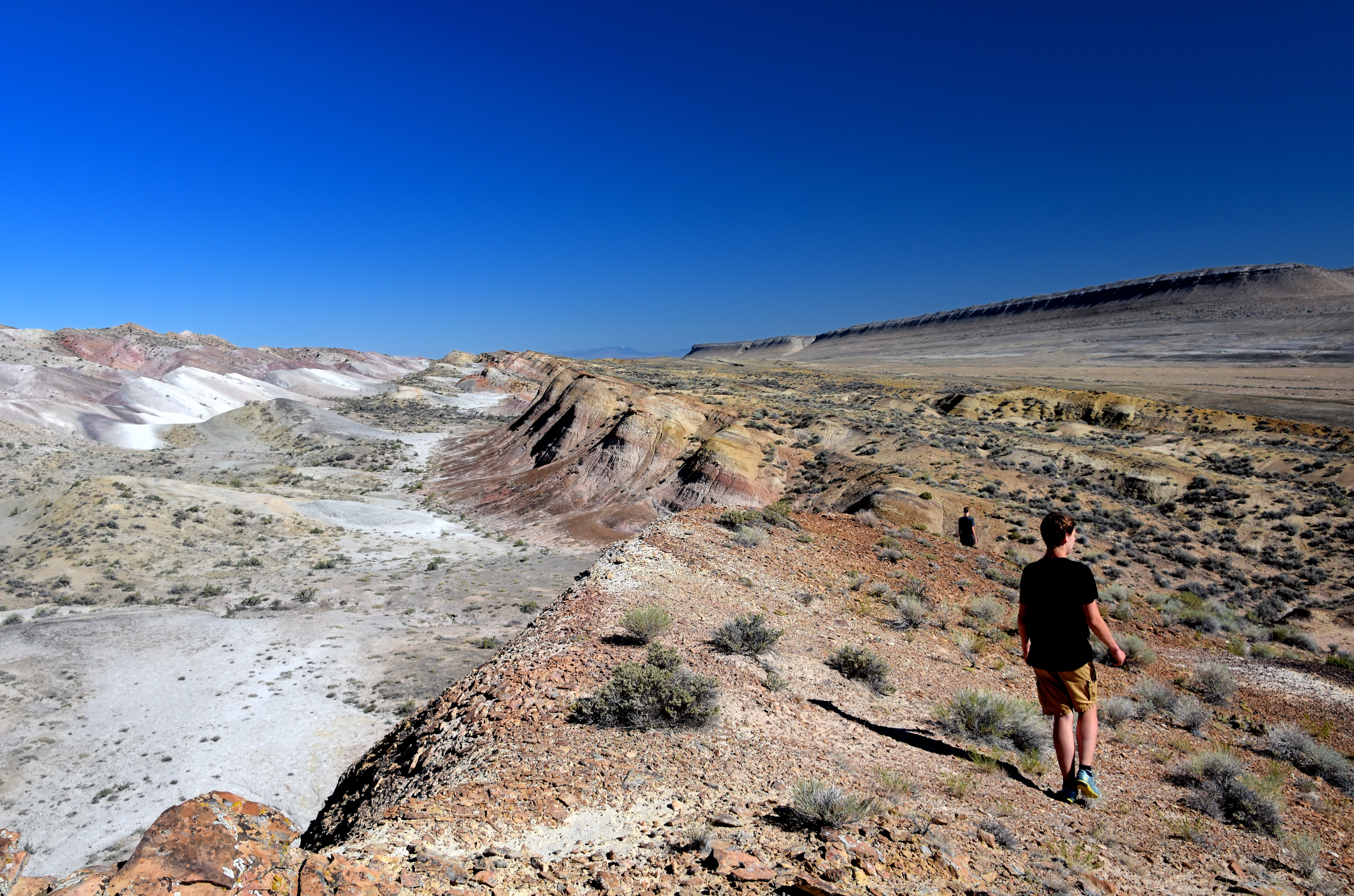 We have arrived at the top of the first large ridge. Looking north you can see how the rock layers are tipped downward to the east. My two oldest sons are looking for a way down into the valley on the left so that we can start working our way up to the next highest ridge. Over the space of a couple of miles we went up and down many times eventually reaching higher and higher ridges as we went. In the distance you can see a flat topped mountain. The layers of rock in this mountain are almost completely horizontal.
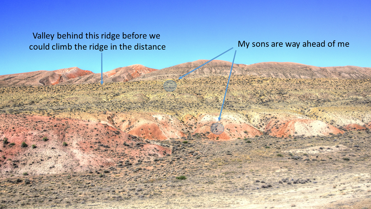 We have already climbed half way up this part of sheep mountain when I took this picture of what was ahead. I have circled my two sons who are way ahead of me at this point. I could say I was distracted by my hunt for fossils but my lagging behind was probably a reflection of my physical condition compared to theirs. They are also in rock that is 10 t0 20 million years older than where I stand. They are working up into the Gypsum Spring rock formation from the Middle Jurassic Periods and I am still hanging out in the Upper Jurassic Sundance rock formation.

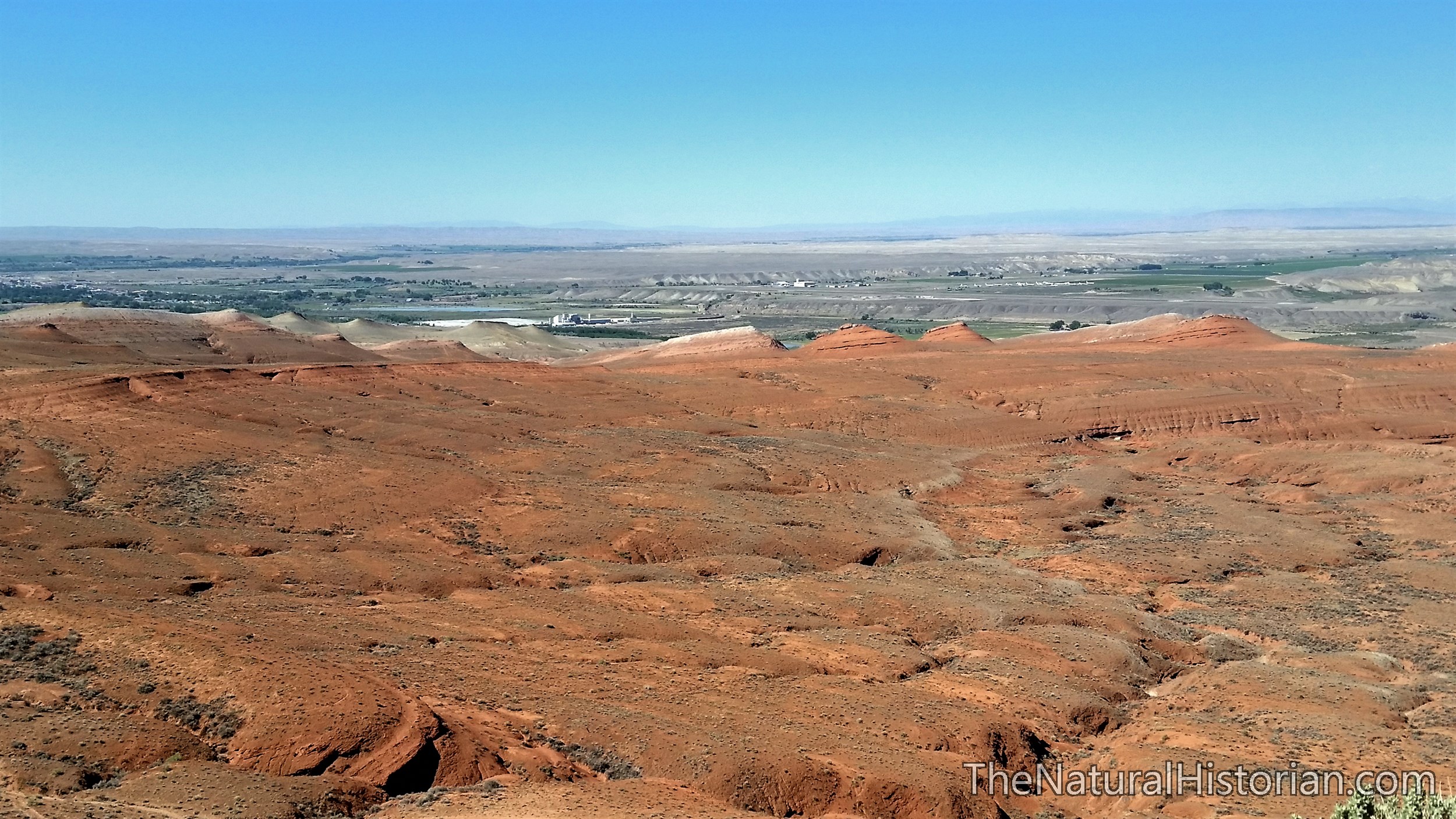 Looking southwest from the top of the main ridge toward Greybull, Wyoming. This red rock is from the Chugwater Formation which is from the upper Triassic Period. So, as we look down into the eroded inner portion of the anticline we are looking back to the period before the Jurassic. The characteristics of this red sandstone are quite different than the rocks that are above them. I didn’t have much interest in climbing down through the red rock because fossils are considered very rare in this rock formation.
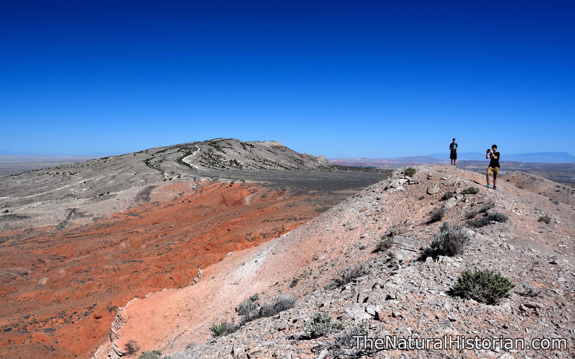
Standing on the highest ridge looking north. The main portion of Sheep Mountain is in the distance on the left. There is a very distinct line that separates the very thick layers – hundreds of feet – of red sandstone from the much lighter rocks above. As far as I could tell from my geological maps, this is the boundary between the Triassic and Jurassic Periods. These red sandstone deposits are non-marine in origin and represent river deltas, sand dunes and other silt and sand deposits. The few fossils that are found in these red rocks are land-dwelling amphibians and reptiles but no placental mammals. The contrast between these rocks and the fossils that we will find as we move through the Jurassic is quite dramatic.
 On our hike up Sheep Mountain I kept my eyes on the ground looking for fossils. For the first mile I didn’t find a single fossil. Then suddenly in the Sundance Formation rocks we stumbled on several layers of eroded rock in which fossils were so prevalent that you could not walk without stepping on them. On our return we spent some time mapping out where we saw fossils and I took many pictures and we collected representative examples of what we saw.
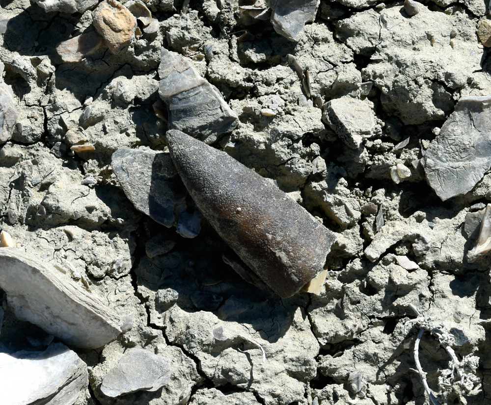
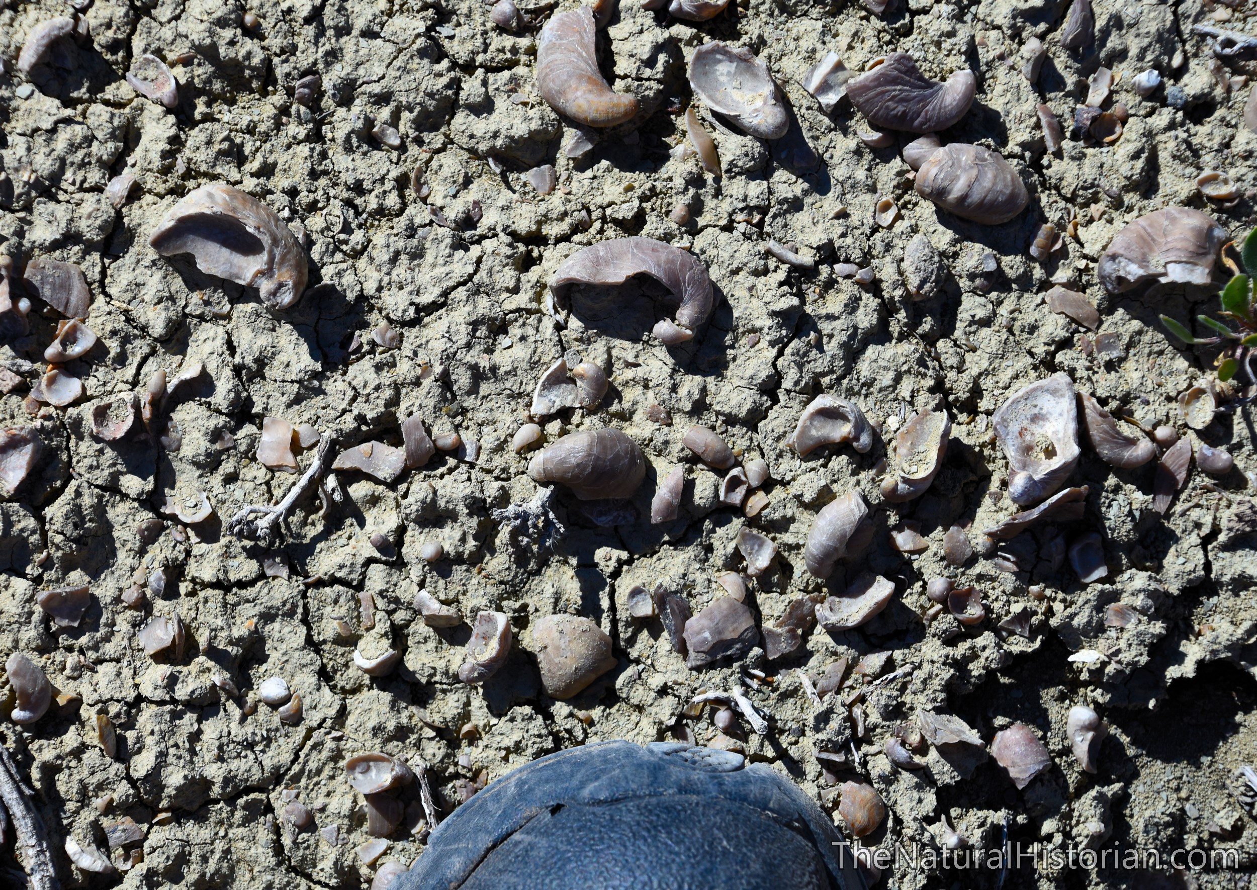
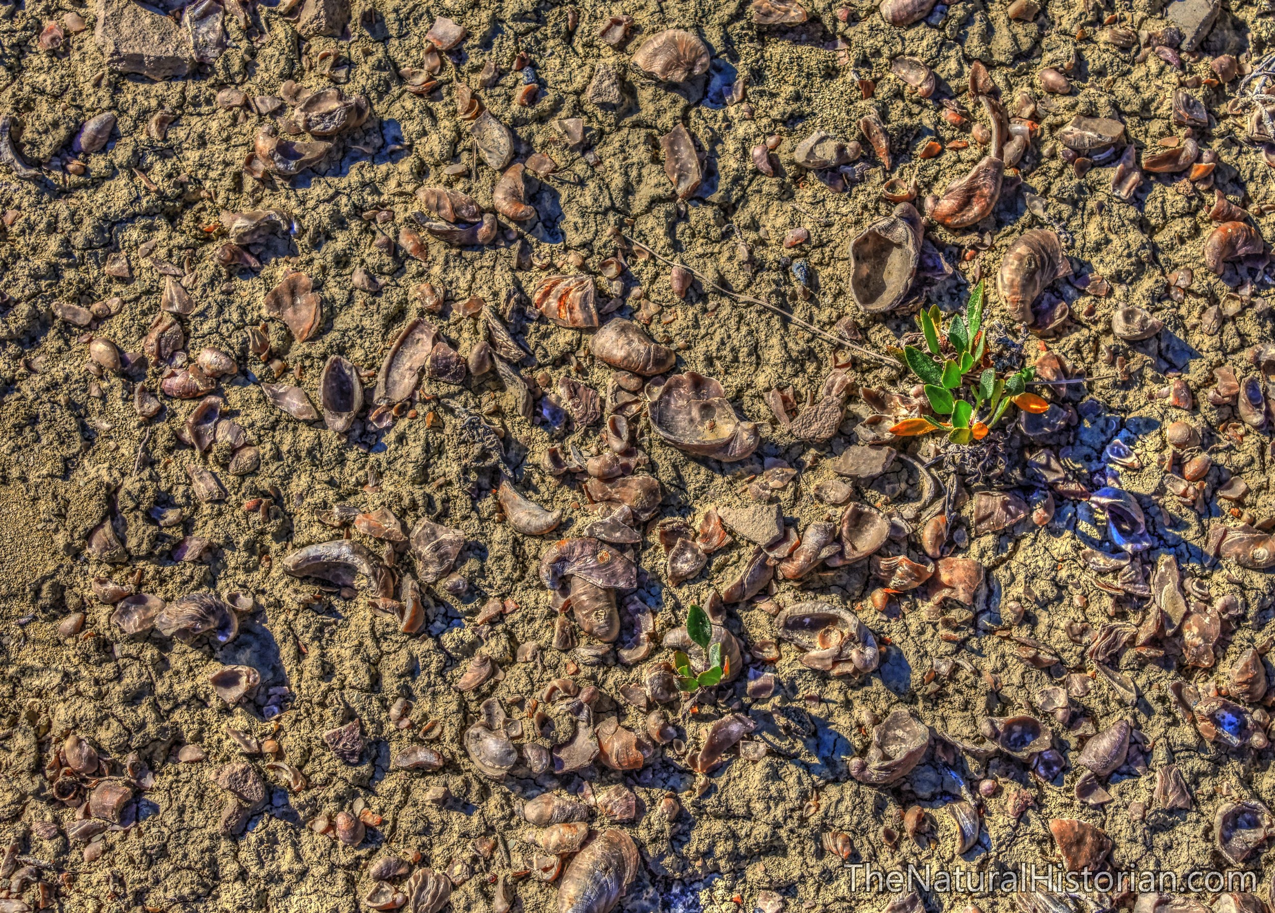
In the picture above I am looking down at the ground. What I could see was a ground littered with two different types of fossils. The first consisted of uncountable numbers of fragments of a large bivalve mollusk. We looked but could not find any shells that were complete. This is typical of a shallow tidal area where shells are being moved around quite vigorously. It also may be due to their relative fragile nature and the process of eroding from the rock resulted in fragmentation. The second fossil is far more interesting. In the picture above I have placed arrows indicating the position of every belemnite fragment. Belemnites are the hard portion of an interior skeleton of an extinct order of squid-like cephalopods.
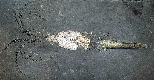
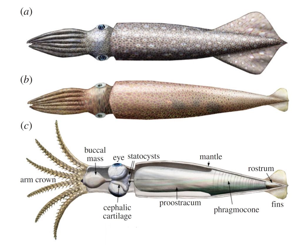
Above is a picture of a rare complete fossil of a Belemnite with several reconstructions of what they may have looked like when alive. Belemnites are found in great abundance in the fossil record but most of those finds are just like the ones we found: the fossilized interior skeletal part called the rostrum. So what you are seeing in my pictures above and below are the only part of these animals to have been preserved for us.

Above and below are some larger belemnites (about 2 inches long) just as we found them. Over just a few hundred square feet we saw 10s of thousands of belemnites and surely hundreds of thousands of shell fragments.
The belemnites would have been swimming in a shallow sea. If they were eaten by a sea reptile or shark it is thought that the indigestible inner skeletons could been vomited up in large numbers onto the seafloor. Also, as any died they would have eventually decayed leaving only this rostrums in the sandy sea bottom along with the ubiquitous mollusk shells.
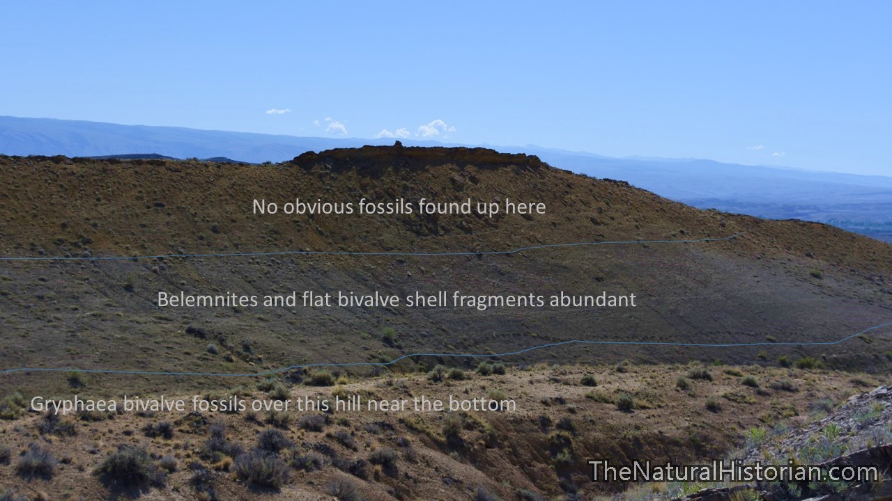
 Now, here is where the story gets more interesting. The shells and belemnites were only found in a 40 to 50 foot-thick section of sediment. Just below these sediments there were no belemnites other than a few that looked to have been washed down from the rock/sediment from above. But going a bit further down in the rock record we suddenly found ourselves on another hillside which was covered with fossils. But these were not the same type of fossils. Here what we found were billions and billions of pieces of an extinct fossil clam called Gryphaea. The picture above is representative of what the ground looked like that we walked on for another 40 feet as we made our way up Sheep Mountain.
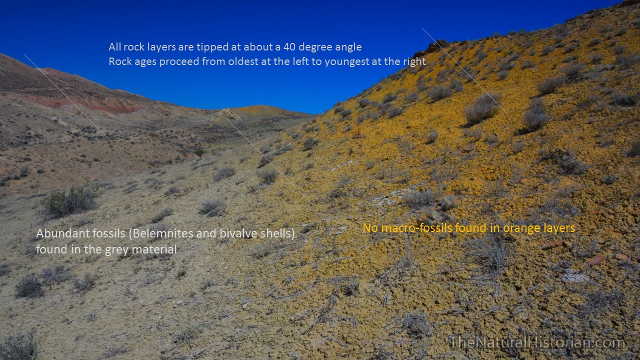 In the picture above looking north along a ridge we had just passed over, I have increased the color contrast so that you can see the differences in the sediment colors a bit better. The orange layers of sediment had no obvious fossils even after walking the length of the area you can see in this image. The grey layers below is where suddenly – and I mean within 1 foot of leaving the orange area – the ground was covered with shell fragments and belemnites.
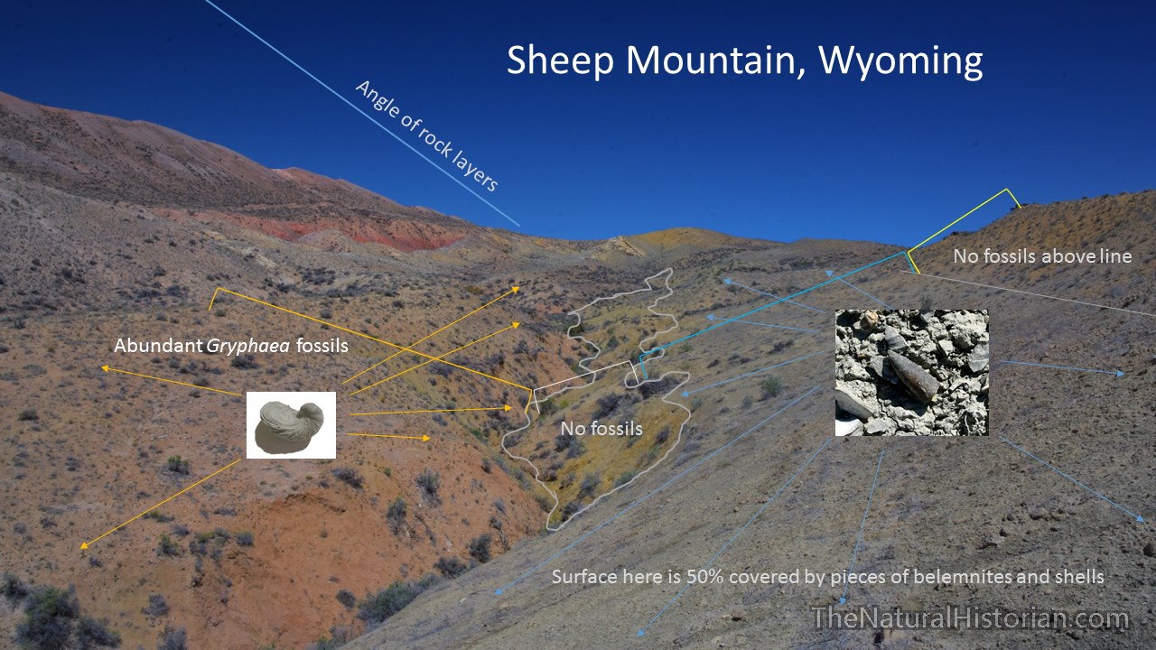 Remember the bedrock is tipped on Sheep Mountain. On the right side of this picture the rock is younger. The grey rock contains the belemnites but then there is another area of orange-tainted rock where I found no fossils. But after crossing the gully going down the center of this image which is cutting through the softest rock we found ourselves in a grey to slightly red hillside whose surface was covered with Gryphaea fossils. So the differences we saw after crossing the gully was quite dramatic. Had we walked north and south on the right side of this gully we would have seen set of fossils not knowing that 50 feet away there was a completely different set of fossils. But that is what makes hiking a mountain like this so great. We were constantly crossing through rocks deposited at different time and under different conditions.
 If you have read this far and you read my article about the Red Gulch dinosaur tracks you might start seeing a theme. In a future post we will go to a few other fossil locations and we are going to see the same types of fossils in the same order and same types of rocks but we will be 10 to 40 miles away form this location.
 I will leave you with this processed image of a fossil-rich site on our hike. I have increased the contrast and color saturation to bring out the fossils.
Klug, C., Schweigert, G., Fuchs, D., Kruta, I., Tischlinger, H. 2016. Adaptations to squid-style high-speed swimming in Jurassic belemnitids. Biology Letters. doi: 10.1098/rsbl.2015.0877
d

Fun story and great photos. Very cool annotations. As a career geologist, current brewery owner/operator in Billings, I’m planning to visit the classic anticline next month. Can you show a map or verbal description of your access route? Thanks much!
LikeLike
Thanks. I’ll try this google maps link first. We parked just north of where Crystal creek Road breaks off the mining road. Hiked toward west to ridge overlooking red rocks. https://www.google.com/maps/@44.5579826,-108.0227559,2088m/data=!3m1!1e3
LikeLike
Just realized that two roads are called Crystal Creek. Its the smaller Crystal creek road running north. Right above that dark spot on the west side of the road (a small dry pond) is where I parked. We then hiked directly west. Fossil area in the last valley before the main climb to the ridge.
LikeLike
And you have to visit the “Devils Kitches about 1 mile to the south east of that spot.
LikeLike
Thanks so much for all your info. Very kind! My buds distracted me to hike the high country this summer, but now that Fall is here I got free to take a recon visit to The Cline (as I call it). I blasted down today, Thursday, but had to be back to work by 6pm (ok Jazz Jam and backgammon). I drove to Greybull and found the Crystal Creek road…what a fine road! I took several dirt road cutoffs to head westward and enjoyed the scenes and checking a few outcrops. I was disappointed with my lack of good recon tho, as several dirt roads ended in private property. On one road, I thought I was going to where the Big Horn River exits through the canyon but the road was blocked. Sheez. I hiked around a bit and found good stuff as you did tho. But time was short so I headed home for a pint and good music. I’ll be more detailed next time and hike to the top The Cline! Are you local?
LikeLike